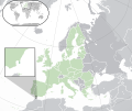
File:EU-Gibraltar.svg

此SVG文件的PNG预览的大小:713 × 600像素。 其他分辨率:285 × 240像素 | 571 × 480像素 | 913 × 768像素 | 1,218 × 1,024像素 | 2,435 × 2,048像素 | 2,045 × 1,720像素。
原始文件 (SVG文件,尺寸为2,045 × 1,720像素,文件大小:7.55 MB)
文件历史
点击某个日期/时间查看对应时刻的文件。
| 日期/时间 | 缩略图 | 大小 | 用户 | 备注 | |
|---|---|---|---|---|---|
| 当前 | 2021年10月19日 (二) 23:01 |  | 2,045 × 1,720(7.55 MB) | Rob984 | Reverted to version as of 01:57, 8 November 2017 (UTC) Gibraltar is no longer in the EU. This map shows the Gibraltar inside the EU, during which the UK was also inside the EU. |
| 2020年7月1日 (三) 02:44 |  | 2,045 × 1,720(7.53 MB) | De728631 | Brexit update | |
| 2017年11月8日 (三) 01:57 |  | 2,045 × 1,720(7.55 MB) | Rob984 | Added circle for clarity | |
| 2017年11月8日 (三) 00:36 |  | 2,045 × 1,720(7.59 MB) | Rob984 | Reverted to version as of 15:30, 7 August 2014 (UTC) These look terrible, use pastel colours at least | |
| 2017年7月18日 (二) 16:16 |  | 2,045 × 1,720(7.55 MB) | Renamed user OCfxJKu7j2 | More distinct UK | |
| 2017年6月29日 (四) 10:39 |  | 2,045 × 1,720(7.55 MB) | RaviC | Slightly increased shading for the UK in line with other location maps | |
| 2014年8月7日 (四) 15:30 |  | 2,045 × 1,720(7.59 MB) | Rob984 | {{Information |Description ={{en|1={{legend|#218439|'''(Green)''' {{W|Gibraltar}}.}} {{legend|#c6debd|'''(Light-green)''' The {{W|European Union}} (EU).}} {{legend|#c0c1c5|'''(Grey)''' {{W|Europe}}.}} {{legend|#ccced1|'''(Light-grey)''' The surround... |
文件用途
以下页面使用本文件:
全域文件用途
以下其他wiki使用此文件:
- ar.wikipedia.org上的用途
- azb.wikipedia.org上的用途
- bh.wikipedia.org上的用途
- bn.wikipedia.org上的用途
- cdo.wikipedia.org上的用途
- en.wikipedia.org上的用途
- es.wikipedia.org上的用途
- eu.wikipedia.org上的用途
- fi.wikipedia.org上的用途
- fy.wikipedia.org上的用途
- gu.wikipedia.org上的用途
- hak.wikipedia.org上的用途
- io.wikipedia.org上的用途
- is.wikipedia.org上的用途
- ja.wikipedia.org上的用途
- ka.wikipedia.org上的用途
- ml.wikipedia.org上的用途
- my.wikipedia.org上的用途
- pa.wikipedia.org上的用途
- pnb.wikipedia.org上的用途
- sco.wikipedia.org上的用途
- simple.wikipedia.org上的用途
- si.wikipedia.org上的用途
- sk.wikipedia.org上的用途
- smn.wikipedia.org上的用途
- so.wikipedia.org上的用途
- szl.wikipedia.org上的用途
- ta.wikipedia.org上的用途
- ur.wikipedia.org上的用途
- wuu.wikipedia.org上的用途
- zh-classical.wikipedia.org上的用途
- zh-min-nan.wikipedia.org上的用途
