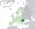
File:EU-Romania.svg

此SVG文件的PNG预览的大小:713 × 600像素。 其他分辨率:285 × 240像素 | 571 × 480像素 | 913 × 768像素 | 1,218 × 1,024像素 | 2,435 × 2,048像素 | 2,045 × 1,720像素。
原始文件 (SVG文件,尺寸为2,045 × 1,720像素,文件大小:7.33 MB)
文件历史
点击某个日期/时间查看对应时刻的文件。
| 日期/时间 | 缩略图 | 大小 | 用户 | 备注 | |
|---|---|---|---|---|---|
| 当前 | 2020年2月1日 (六) 05:30 |  | 2,045 × 1,720(7.33 MB) | Rob984 | UK and Gibraltar have left the EU. New base which includes all of Portugal's islands within frame, as well as Arctic Russian islands part of Europe. Also fixed Flevoland in the Netherlands. |
| 2016年10月25日 (二) 20:35 |  | 2,045 × 1,720(7.32 MB) | Giorgi Balakhadze | + some lakes | |
| 2013年7月1日 (一) 09:38 |  | 2,045 × 1,720(2.61 MB) | U5K0 | croatia | |
| 2009年10月23日 (五) 14:45 |  | 2,045 × 1,720(2.59 MB) | NuclearVacuum | consensus version | |
| 2009年10月18日 (日) 18:29 |  | 2,045 × 1,720(2.62 MB) | NuclearVacuum | final version | |
| 2009年10月17日 (六) 17:52 |  | 680 × 520(530 KB) | NuclearVacuum | new | |
| 2009年10月17日 (六) 16:39 |  | 680 × 520(526 KB) | NuclearVacuum | {{Information |Description={{en|1={{EU-SVG-en|Romania}}}} |Source=*File:Blank map europe.svg<br>{{Inkscape}} |Author=NuclearVacuum |Date=2009-10 |Permission= |other_versions=*File:Location Romania EU Europe.PNG }} [[Categ |
文件用途
以下4个页面使用本文件:
全域文件用途
以下其他wiki使用此文件:
- ady.wikipedia.org上的用途
- af.wikipedia.org上的用途
- als.wikipedia.org上的用途
- ami.wikipedia.org上的用途
- am.wikipedia.org上的用途
- ar.wikipedia.org上的用途
- رومانيا
- بوابة:البلقان/دولة مختارة/أرشيف
- بوابة:البلقان/دولة مختارة/6
- مستخدم:ElWaliElAlaoui/ملعب 8
- معاملة المثليين في رومانيا
- مستخدم:جار الله/قائمة صور مقالات العلاقات الثنائية
- العلاقات الأمريكية الرومانية
- العلاقات الأنغولية الرومانية
- العلاقات الرومانية الكورية الجنوبية
- العلاقات الإريترية الرومانية
- العلاقات الرومانية السويسرية
- العلاقات الألمانية الرومانية
- العلاقات الرومانية الليختنشتانية
- العلاقات البوليفية الرومانية
- العلاقات الرومانية الموزمبيقية
- العلاقات الألبانية الرومانية
- العلاقات البلجيكية الرومانية
- العلاقات الإثيوبية الرومانية
- العلاقات البيلاروسية الرومانية
- العلاقات الرومانية الطاجيكستانية
- العلاقات الروسية الرومانية
- العلاقات الأرجنتينية الرومانية
- العلاقات الرومانية الغامبية
- العلاقات الرومانية القبرصية
- العلاقات الرومانية السيراليونية
- العلاقات الرومانية النيبالية
- العلاقات الرومانية الليبيرية
- العلاقات التشيكية الرومانية
- العلاقات الرومانية الميانمارية
- العلاقات الرومانية الكندية
- العلاقات الرومانية الزيمبابوية
- العلاقات الإسرائيلية الرومانية
- العلاقات البالاوية الرومانية
- العلاقات الرومانية المالية
- العلاقات الرومانية النيجيرية
- العلاقات اليمنية الرومانية
- العلاقات الرومانية الفانواتية
- العلاقات الغابونية الرومانية
- العلاقات البنمية الرومانية
- العلاقات الرومانية الكوبية
- العلاقات الجورجية الرومانية
- العلاقات التونسية الرومانية
- العلاقات الرومانية الكورية الشمالية
- العلاقات الهندية الرومانية
- العلاقات اليابانية الرومانية
查看本文件的更多全域用途。
