File:Grossdeutsches Reich.jpg

本预览的尺寸:733 × 600像素。 其他分辨率:293 × 240像素 | 587 × 480像素 | 939 × 768像素 | 1,252 × 1,024像素 | 2,503 × 2,048像素 | 9,839 × 8,050像素。
原始文件 (9,839 × 8,050像素,文件大小:10.86 MB,MIME类型:image/jpeg)
摘要
| 警告 | 部分浏览器在浏览此图片的完整大小时可能会遇到困难:该图片中有数量巨大的像素点,可能无法完全载入或者导致您的浏览器停止响应。 |
|---|
| 描述 |
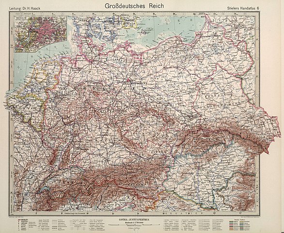
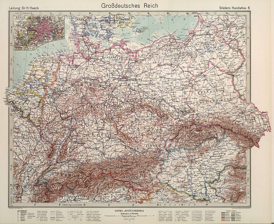
English: Outline color. Text/Index Map pages printed in blue ink. Relief shown by hachures. Editions of this atlas extended through the years of World War II. This edition is the last edition of the Stieler atlas. It is very rare and known only in a few copies. It was printed during the final months of World War II, probably in April or May of 1945. |
|||||||
| 日期 | 1944, 10th edition. Further informations: Stielers Hand-Atlas (1817-1945). | |||||||
| 来源 | Stielers Hand-Atlas. 254 Haupt- und Nebenkarten in Kupferstich. Zehnte Auflage Hundertjahr - Ausgabe. Herausegeben unter Leitung von Prof. Dr. H. Haack, in Justus Perthes' Geogr. Anstalt. Gotha: Justus Perthes. >> (David Rumsey Historical Map Collection ). Original image resized and compressed before uploading. | |||||||
| 作者 | Adolf Stieler (1775-1836). | |||||||
| 授权 (二次使用本文件) |
|
|||||||
| 其他版本 |
|
|||||||

.jpg)
文件历史
点击某个日期/时间查看对应时刻的文件。
| 日期/时间 | 缩略图 | 大小 | 用户 | 备注 | |
|---|---|---|---|---|---|
| 当前 | 2018年6月21日 (四) 15:39 | | 9,839 × 8,050(10.86 MB) | FDRMRZUSA | User created page with UploadWizard |
文件用途
以下页面使用本文件:
全域文件用途
以下其他wiki使用此文件:
- af.wikipedia.org上的用途
- de.wikipedia.org上的用途
- en.wikipedia.org上的用途
- it.wikipedia.org上的用途
- pt.wikipedia.org上的用途