File:Huanghemap zh-hans.png
本预览的尺寸:800 × 407像素。 其他分辨率:320 × 163像素 | 640 × 326像素 | 1,024 × 521像素 | 1,280 × 652像素 | 2,160 × 1,100像素。
原始文件 (2,160 × 1,100像素,文件大小:152 KB,MIME类型:image/png)
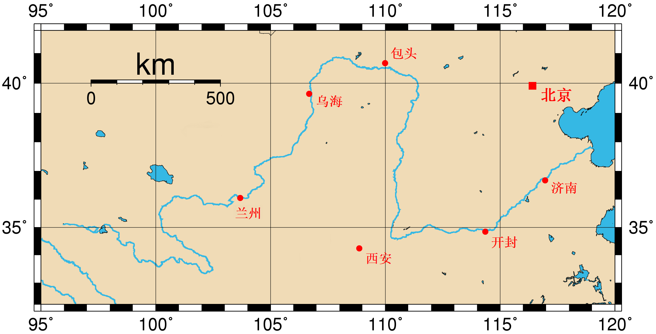
| 描述 | Map of the Huang He and the location of major cities along its course. This map was generated using the Generic Mapping Tools (GMT). The city coordinates (longitude, latitude) used are: *103.6833 36.0500 Lanzhou *106.6833 39.6500 Wuhai *109.9833 40.6666 Baotou *114.3500 34.8500 Kaifeng *116.9600 36.6666 Jinan *108.8666 34.2500 Xi'an *116.4166 39.9166 Beijing |
| 日期 | (UTC) |
| 来源 | |
| 作者 |
|
| 这是一张修改过的图片,这意味着它已在原版本的基础上通过软件进行了编辑,改动内容:Chinese Version。其原始版本为:Huanghemap.png。修改者: Crwx。
|
我,本作品著作权人,特此采用以下许可协议发表本作品:
| 本文件采用知识共享署名-相同方式共享 3.0 未本地化版本许可协议授权。 | ||
| ||
| 本许可协议标签作为GFDL许可协议更新的组成部分被添加至本文件。 |

|
已授权您依据自由软件基金会发行的无固定段落及封面封底文字(Invariant Sections, Front-Cover Texts, and Back-Cover Texts)的GNU自由文件许可协议1.2版或任意后续版本的条款,复制、传播和/或修改本文件。该协议的副本请见“GNU Free Documentation License”。 |
您可以选择您需要的许可协议。
原始上传日志
This image is a derivative work of the following images:
- File:Huanghemap.png licensed with Cc-by-sa-3.0-migrated, GFDL
- 2005-07-31T02:50:02Z Fanghong 2160x1100 (96391 Bytes) {{information| |Description =Map of the [[Huang He]] and the location of major cities along its course. This map was generated using the Generic Mapping Tools (GMT). The city coordinates ([[longitude]], [[latitude]]) used are
Uploaded with derivativeFX
文件历史
点击某个日期/时间查看对应时刻的文件。
| 日期/时间 | 缩略图 | 大小 | 用户 | 备注 | |
|---|---|---|---|---|---|
| 当前 | 2010年4月24日 (六) 01:38 | | 2,160 × 1,100(152 KB) | Crwx | {{Information |Description=Map of the Huang He and the location of major cities along its course. This map was generated using the Generic Mapping Tools (GMT). The city coordinates (longitude, latitude) used are: *103.6833 36.0500 Lanzho |
文件用途
以下页面使用本文件: