File:Portugal topographic map-pt.png
本预览的尺寸:339 × 599像素。 其他分辨率:136 × 240像素 | 272 × 480像素 | 435 × 768像素 | 579 × 1,024像素 | 1,738 × 3,070像素。
原始文件 (1,738 × 3,070像素,文件大小:4.6 MB,MIME类型:image/png)
| 描述 |
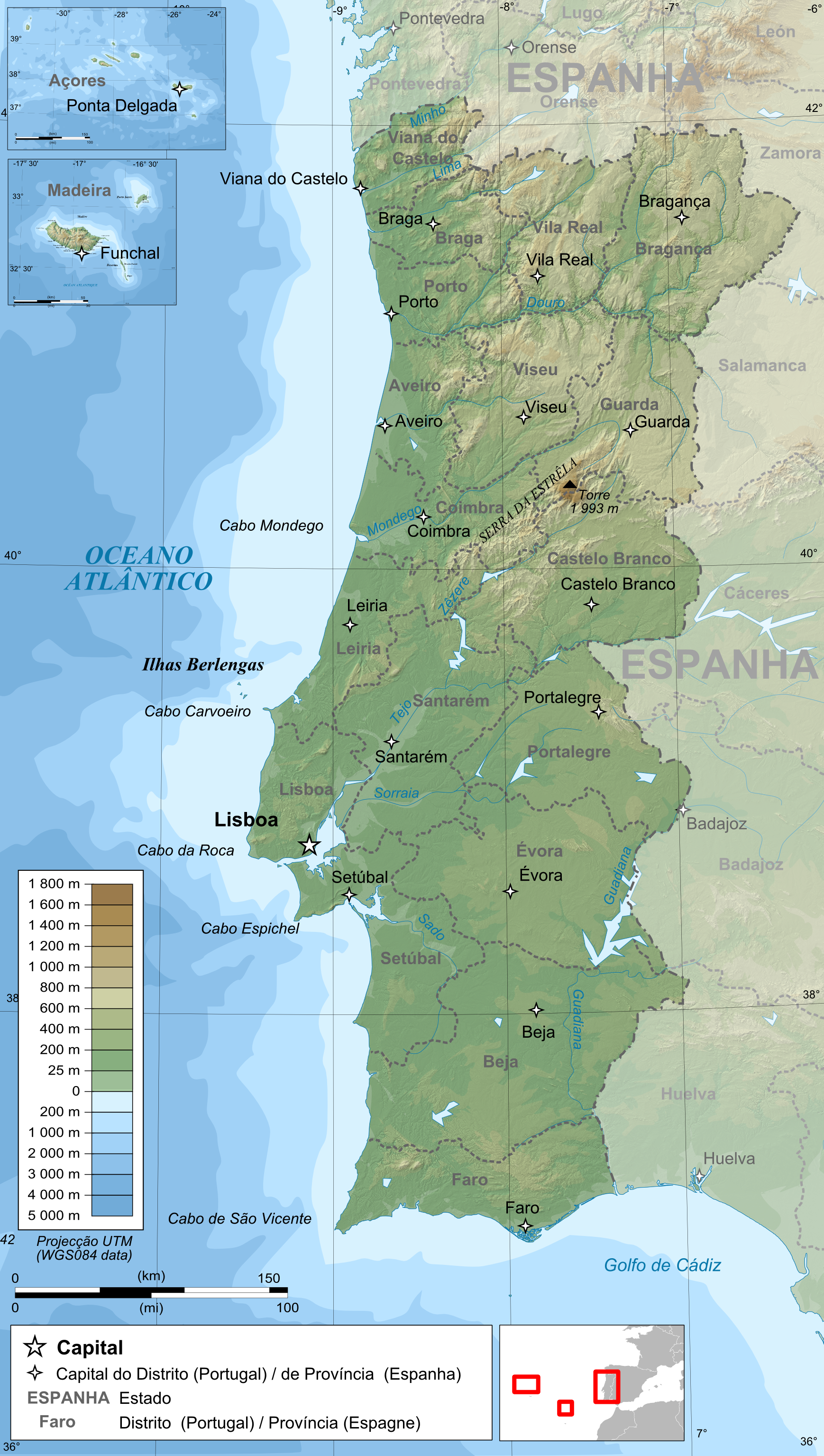
Français : Carte topographique et administrative en portugais du Portugal
Português: Carta topográfica e da administração do Portugal, em português
Deutsch: Topographische Karte von Portugal, portugiesische Version English: Topographic and administrative map in Portuguese of Portugal Español: Mapa topográfico y administrativo en portugés del Portugal Italiano: Carta topografica e amministrativa de Portogallo 日本語: ポルトガル語で表示したポルトガル地形·行政地図 |
||
| 日期 | |||
| 来源 |
English: Own work ;
Français : Création personnelle ;
|
||
| 作者 | Bourrichon - fr:Bourrichon | ||
| 授权 (二次使用本文件) |
我,本作品著作权人,特此采用以下许可协议发表本作品:
您可以选择您需要的许可协议。 |
||
| 其他版本 |
|


文件历史
点击某个日期/时间查看对应时刻的文件。
| 日期/时间 | 缩略图 | 大小 | 用户 | 备注 | |
|---|---|---|---|---|---|
| 当前 | 2009年6月14日 (日) 20:51 | | 1,738 × 3,070(4.6 MB) | Bourrichon | {{Information |Description= {{fr|Carte topographique et administrative en portugais du Portugal}} {{pt|Carta topográfica e da administração do Portugal, em português}} {{de|Topographische Karte von [[:de:Portugal|Port |
文件用途
以下页面使用本文件:
全域文件用途
以下其他wiki使用此文件:
- bxr.wikipedia.org上的用途
- de.wikipedia.org上的用途
- el.wikipedia.org上的用途
- en.wikipedia.org上的用途
- en.wikiversity.org上的用途
- fr.wikipedia.org上的用途
- hr.wikipedia.org上的用途
- hr.wiktionary.org上的用途
- ilo.wikipedia.org上的用途
- ja.wikipedia.org上的用途
- kn.wikipedia.org上的用途
- ko.wikipedia.org上的用途
- la.wiktionary.org上的用途
- lez.wikipedia.org上的用途
- mn.wikipedia.org上的用途
- ps.wikipedia.org上的用途
- pt.wikipedia.org上的用途
- ro.wikipedia.org上的用途
- sd.wikipedia.org上的用途
- sl.wikipedia.org上的用途
- test2.wikipedia.org上的用途
- te.wikipedia.org上的用途
- th.wikipedia.org上的用途
- tr.wikipedia.org上的用途
- vi.wikipedia.org上的用途