File:Second ETR in China.svg

此SVG文件的PNG预览的大小:705 × 599像素。 其他分辨率:282 × 240像素 | 565 × 480像素 | 904 × 768像素 | 1,205 × 1,024像素 | 2,409 × 2,048像素 | 1,000 × 850像素。
原始文件 (SVG文件,尺寸为1,000 × 850像素,文件大小:233 KB)
摘要
| 描述 |
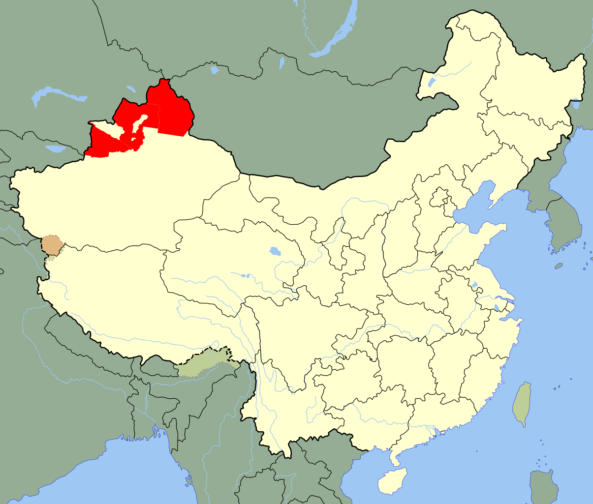
A SVG map of the modern-day districts in which the Second East Turkestan Republic was located; highlighted in red . Legend: |
| 日期 | (UTC) |
| 来源 | |
| 作者 |
|
| SVG开发 |
许可协议
我,本作品著作权人,特此采用以下许可协议发表本作品:
| 我,本作品著作权人,释出本作品至公有领域。这适用于全世界。 在一些国家这可能不合法;如果是这样的话,那么: 我无条件地授予任何人以任何目的使用本作品的权利,除非这些条件是法律规定所必需的。 |
原始上传日志
This image is a derivative work of the following images:
- File:China Xinjiang Ili.svg licensed with PD-self
- 2010-02-12T14:50:12Z Joowwww 1000x850 (238668 Bytes) {{Information |Description=An SVG map of China with Xinjiang highlighted in orange and Ili Prefecture highlighted in red Legend:[[:File:China map legend.png]] |Source=self-made; based on CIA public domain maps: *http://www.l
Uploaded with derivativeFX
文件历史
点击某个日期/时间查看对应时刻的文件。
| 日期/时间 | 缩略图 | 大小 | 用户 | 备注 | |
|---|---|---|---|---|---|
| 当前 | 2020年5月24日 (日) 20:59 | | 1,000 × 850(233 KB) | Roy17 | Reverted to version as of 02:12, 12 July 2010 (UTC) |
| 2020年5月24日 (日) 02:49 |  | 1,000 × 850(271 KB) | Anchuhu | Reverted to version as of 13:12, 19 January 2019 (UTC) USSR still in 1946 and Second ETR controlled larger than ill,include Qaramay | |
| 2020年3月12日 (四) 01:40 |  | 1,000 × 850(233 KB) | Jonteemil | Fake SVG Reverted to version as of 02:12, 12 July 2010 (UTC) | |
| 2019年1月19日 (六) 13:12 |  | 1,000 × 850(271 KB) | 复旦大学张超 | edit | |
| 2010年7月12日 (一) 02:12 |  | 1,000 × 850(233 KB) | Splittist | {{Information |Description=An SVG map of China with Xinjiang's Ili, Tarbaghatai, and Altai districts highlighted in red. These are the districts claimed by the Second East Turkestan Republic. Legend:<br />[[File:Ch |
文件用途
以下7个页面使用本文件:
全域文件用途
以下其他wiki使用此文件:
- ar.wikipedia.org上的用途
- az.wikipedia.org上的用途
- bn.wikipedia.org上的用途
- de.wikipedia.org上的用途
- en.wikipedia.org上的用途
- et.wikipedia.org上的用途
- fr.wikipedia.org上的用途
- id.wikipedia.org上的用途
- it.wikipedia.org上的用途
- ja.wikipedia.org上的用途
- jv.wikipedia.org上的用途
- kk.wikipedia.org上的用途
- mk.wikipedia.org上的用途
- ms.wikipedia.org上的用途
- nl.wikipedia.org上的用途
- pnb.wikipedia.org上的用途
- pt.wikipedia.org上的用途
- ru.wikipedia.org上的用途
- sl.wikipedia.org上的用途
- sv.wikipedia.org上的用途
- th.wikipedia.org上的用途
- tr.wikipedia.org上的用途
- ug.wikipedia.org上的用途
- uk.wikipedia.org上的用途
- ur.wikipedia.org上的用途
- uz.wikipedia.org上的用途
- vi.wikipedia.org上的用途
- www.wikidata.org上的用途