File:Typhoon Mawar 2005 computer simulation thumbnail.gif

Typhoon_Mawar_2005_computer_simulation_thumbnail.gif(450 × 403像素,文件大小:869 KB,MIME类型:image/gif、​循环、​49帧、​5.3秒)


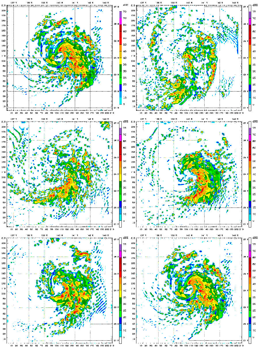
描述 A 48 hour simulation of Typhoon Mawar using the Weather Research and Forecasting model. At this time, Mawar was at approximately 24N 140E and moving slowly to the north. Initial conditions and boundary conditions are from the 1 degree FNL reanalysis (approximately 110 kilometers, 68 miles). The simulation runs from 22 August 2005 00:00 Zulu to 24 August 2005 00:00 Zulu. The model has 3.3 kilometre (2.1 mile) grid point spacing, and utilizes vortex following which is why the typhoon remains in the middle of the frame. Approximately the first 24 hours (frames) show the model "spinning up"— which is the amount of time needed for the model physics to reach equilibrium with the applied boundary conditions. After the initial round of convection in the first couple frames, gravity waves can be seen propagating outward from the center of convection, especially in the northwest quadrant of the storm system. The final 24 hours (frames) represent a high resolution simulation of the actual typhoon. The reds and oranges represent high rainfall rates, blues and greens light rainfall, and the white are regions of no rainfall.
日期 (UTC)
来源
作者


这是一张修改过的图片,这意味着它已在原版本的基础上通过软件进行了编辑,改动内容:create thumbnail。其原始版本为:Typhoon Mawar 2005 computer simulation.gif。修改者: Atmoz

我,本作品著作权人,特此采用以下许可协议发表本作品:
w:zh:知识共享
署名 相同方式共享
您可以自由地:
  • 共享 – 复制、发行并传播本作品
  • 修改 – 改编作品
惟须遵守下列条件:
  • 署名 – 您必须对作品进行署名,提供授权条款的链接,并说明是否对原始内容进行了更改。您可以用任何合理的方式来署名,但不得以任何方式表明许可人认可您或您的使用。
  • 相同方式共享 – 如果您再混合、转换或者基于本作品进行创作,您必须以与原先许可协议相同或相兼容的许可协议分发您贡献的作品。

原始上传日志

This image is a derivative work of the following images:

  • File:Typhoon_Mawar_2005_computer_simulation.gif licensed with Cc-by-sa-3.0
    • 2010-07-01T15:52:43Z Atmoz 1380x1235 (4622294 Bytes) fix transparency "issue"
    • 2010-07-01T15:48:49Z Atmoz 1380x1235 (4627300 Bytes) last frame first
    • 2010-07-01T05:59:02Z Atmoz 1380x1235 (4655873 Bytes) {{Information |Description=A 48 hour simulation of [[w:Typhoon Mawar|Typhoon Mawar]] using the [[w:Weather Research and Forecasting model|Weather Research and Forecasting model]]. Initial conditions and boundary conditions ar

Uploaded with derivativeFX

说明

添加一行文字以描述该文件所表现的内容

此文件中描述的项目

描绘内容

文件历史

点击某个日期/时间查看对应时刻的文件。

日期/时间缩⁠略⁠图大小用户备注
当前2010年7月1日 (四) 15:592010年7月1日 (四) 15:59版本的缩略图450 × 403(869 KB)Atmoz{{Information |Description=A 48 hour simulation of Typhoon Mawar using the Weather Research and Forecasting model. Initial conditions and boundary conditions are 1 degree reanalysis. |Source

以下页面使用本文件:

全域文件用途

以下其他wiki使用此文件:

元数据