File:Cordón del Azufre.jpg
没有更高的分辨率。
Cordón_del_Azufre.jpg (640 × 422像素,文件大小:74 KB,MIME类型:image/jpeg)
摘要
| 描述 |
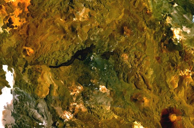
English: The volcanic complex in the center of this NASA Landsat composite image is Cordón del Azufre, a small volcanic center straddling the Chile-Argentina border. A dacitic lava-dome complex lies at the eastern side of the complex, in Argentina. The prominent dark-colored lava flow from Volcán la Moyra, the youngest feature of the volcanic field, descended 6 km into Chile and 3 km into Argentina. Lava flows from Bayo volcano to the SW are visible at the lower left. |
| 日期 | 未知日期 |
| 来源 | http://www.volcano.si.edu/world/volcano.cfm?vnum=1505-121&volpage=photos&photo=115040 |
| 作者 | NASA Landsat7 image (worldwind.arc.nasa.gov) |
许可协议
| 本图像属于 w:公有领域 ,因其为 NASA 的 World Wind 卫星地图浏览器的一张截图,且使用了公有领域图层,如 Blue Marble、MODIS、Landsat、SRTM、USGS、GLOBE 等。
|
 |
文件历史
点击某个日期/时间查看对应时刻的文件。
| 日期/时间 | 缩略图 | 大小 | 用户 | 备注 | |
|---|---|---|---|---|---|
| 当前 | 2010年10月16日 (六) 19:02 | | 640 × 422(74 KB) | Michael Metzger | {{Information |Description={{en|1=The volcanic complex in the center of this NASA Landsat composite image is Cordón del Azufre, a small volcanic center straddling the Chile-Argentina border. A dacitic lava-dome complex lies at the eastern side of the com |
文件用途
以下页面使用本文件:
全域文件用途
以下其他wiki使用此文件:
- arz.wikipedia.org上的用途
- ceb.wikipedia.org上的用途
- de.wikipedia.org上的用途
- en.wikipedia.org上的用途
- es.wikipedia.org上的用途
- eu.wikipedia.org上的用途
- fa.wikipedia.org上的用途
- fr.wikipedia.org上的用途
- hu.wikipedia.org上的用途
- id.wikipedia.org上的用途
- lld.wikipedia.org上的用途
- ms.wikipedia.org上的用途
- pl.wikipedia.org上的用途
- sk.wikipedia.org上的用途
- sv.wikipedia.org上的用途
- www.wikidata.org上的用途