File:Whitehall1680.jpg
預覽大小:800 × 571 像素。 其他解析度:320 × 229 像素 | 640 × 457 像素 | 1,024 × 732 像素 | 1,280 × 914 像素 | 1,691 × 1,208 像素。
原始檔案 (1,691 × 1,208 像素,檔案大小:428 KB,MIME 類型:image/jpeg)
摘要
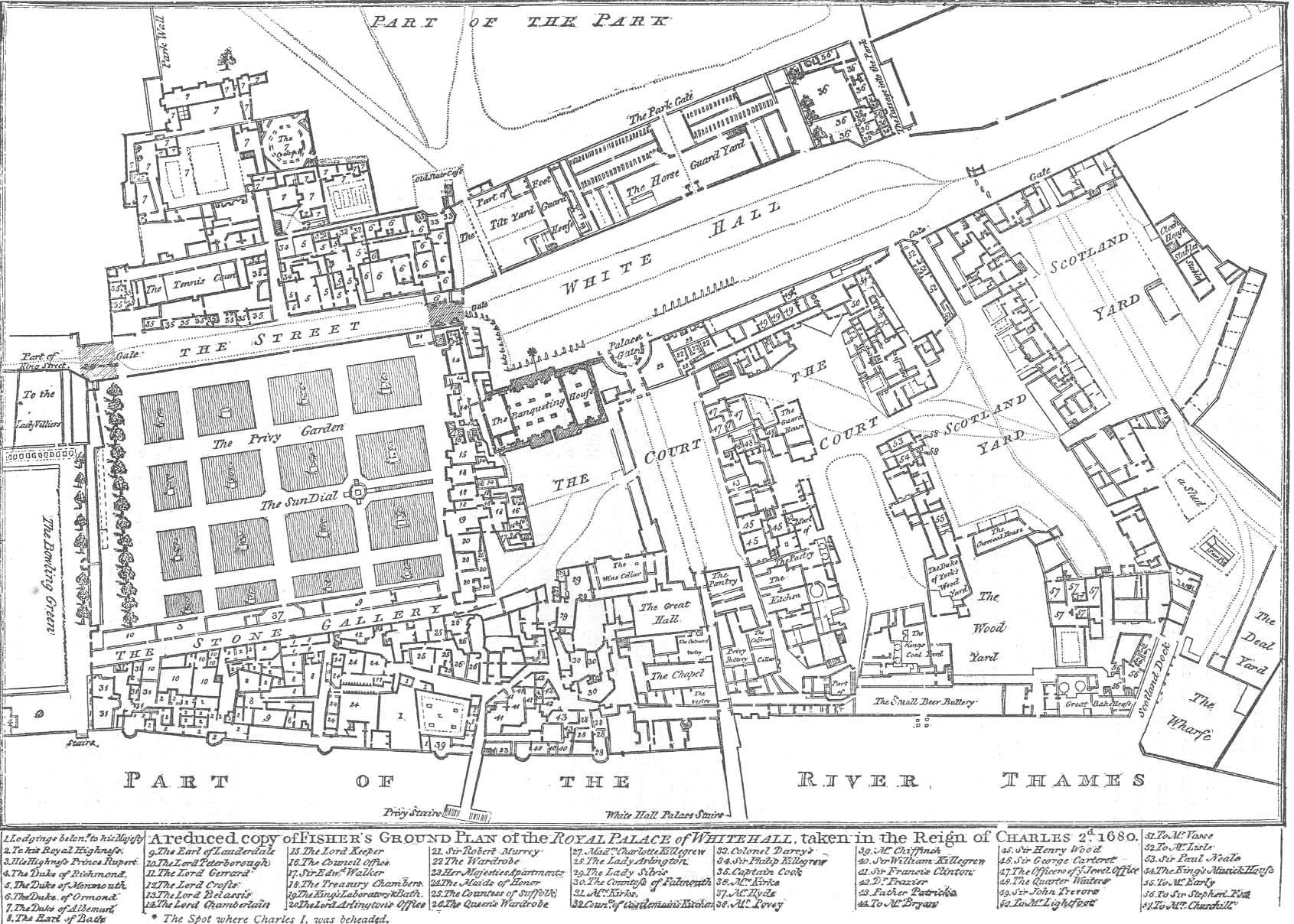
English: Fisher's ground plan of the Palace of Whitehall in London in 1680. This 1807 edition is from the Crace Collection at the British Library. The annotations may more easily be read on the zoomable version here. The black spot outside the Banqueting House marks the spot where Charles I was executed.
Français : Plan du palais de Whitehall en 1680 (le nord est à droite), la Maison des banquets est au centre du plan.
Español: Plano del Palacio de Whitehall en 1680 (el norte está a la derecha de la imagen); la 'Casa de los Banquetes' está al centro del plano.
授權條款
|
本作品在其來源國以及其他著作權期限是作者逝世後70年或以下的國家與地區屬於公有領域。 | |
| 此作品無已知的著作權限制,亦不受所有相關和鄰接的權利限制。 | |
檔案歷史
點選日期/時間以檢視該時間的檔案版本。
| 日期/時間 | 縮圖 | 尺寸 | 使用者 | 備註 | |
|---|---|---|---|---|---|
| 目前 | 2011年3月20日 (日) 17:52 | | 1,691 × 1,208(428 KB) | Alexrk2 | larger size |
| 2006年2月23日 (四) 18:03 |  | 712 × 512(171 KB) | Merchbow~commonswiki | Fisher's ground plan of the Palace of Whitehall in London in 1680. This 1807 edition is from the Crace Collection at the British Library. Category:Palace of Whitehall Category:Architectural plans |
檔案用途
下列頁面有用到此檔案:
全域檔案使用狀況
以下其他 wiki 使用了這個檔案:
- en.wikipedia.org 的使用狀況
- en.wikinews.org 的使用狀況
- es.wikipedia.org 的使用狀況
- fa.wikipedia.org 的使用狀況
- fr.wikipedia.org 的使用狀況
- hy.wikipedia.org 的使用狀況
- it.wikipedia.org 的使用狀況
- ru.wikipedia.org 的使用狀況
- sl.wikipedia.org 的使用狀況
- tr.wikipedia.org 的使用狀況
- uk.wikipedia.org 的使用狀況
- uz.wikipedia.org 的使用狀況