纳塔莱斯港
智利南部城鎮
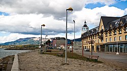
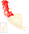
纳塔莱斯港是智利的城镇,位于该国南部,由麦哲伦-智利南极大区负责管辖,也是乌尔蒂马埃斯佩兰萨省的首府,始建于1911年,面积48,974平方公里,海拔高度3米,2002年人口19,116,人口密度每平方公里0.4人。
| 纳塔莱斯港 Puerto Natales | |
|---|---|
| 市 | |
 | |
| 绰号:Natales | |
| 坐标 (city):51°44′S 72°31′W / 51.733°S 72.517°W | |
| 国家 | |
| 大区 | |
| 省份 | 乌尔蒂马埃斯佩兰萨省 |
| 县市 | 纳塔莱斯 |
| Founded | 1911 |
| 政府[1] [2] | |
| • 类型 | 基层政权 |
| • 镇长 | Fernando Paredes Mansilla (UDI) |
| 面积[3] | |
| • 总计 | 48,974.2 平方公里(18,909.0 平方英里) |
| 海拔 | 3 米(10 英尺) |
| 人口(2012 Census)[3] | |
| • 总计 | 18,505人 |
| • 密度 | 0.378人/平方公里(0.979人/平方英里) |
| • 乡村 | 2,138 |
| Sex[3] | |
| • Men | 10,068 |
| • Women | 9,048 |
| 时区 | CLST(UTC−3) |
| 电话区号 | 56 + 61 |
| 网站 | www.muninatales.cl |
相片集
编辑外部链接
编辑- News from Puerto Natales and torres del paine (页面存档备份,存于互联网档案馆)
- Patagonia Webcam from Paine and Puerto Natales (页面存档备份,存于互联网档案馆)
- Google map of Natales, Chile (页面存档备份,存于互联网档案馆)
- View the Navimag's route from Puerto Montt to Puerto Natales through the Chilean fjords in Google Earth
- Panoramic virtual tour of Ultima Esperanza Sound from Puerto Natales
- Travel Guide Puerto Natales
| 这是一篇与智利地理相关的小作品。您可以通过编辑或修订扩充其内容。 |
- ^ Asociación Chilena de Municipalidades. [27 January 2011]. (原始内容存档于2021-01-17) (西班牙语).
- ^ Municipality of Puerto Natales. [27 January 2011]. (原始内容存档于2021-01-17) (西班牙语).
- ^ 3.0 3.1 3.2 National Statistics Institute. [27 January 2010]. (原始内容存档于2019-01-06) (西班牙语).


