File:1968 The main townships of Fuzhou, Fubei, and Shangdongdu.tif

此TIF文件的JPG预览的大小:697 × 599像素。 其他分辨率:279 × 240像素 | 558 × 480像素 | 893 × 768像素 | 1,191 × 1,024像素 | 2,382 × 2,048像素 | 5,712 × 4,912像素。
原始文件 (5,712 × 4,912像素,文件大小:26.76 MB,MIME类型:image/tiff)
摘要
| 描述 |
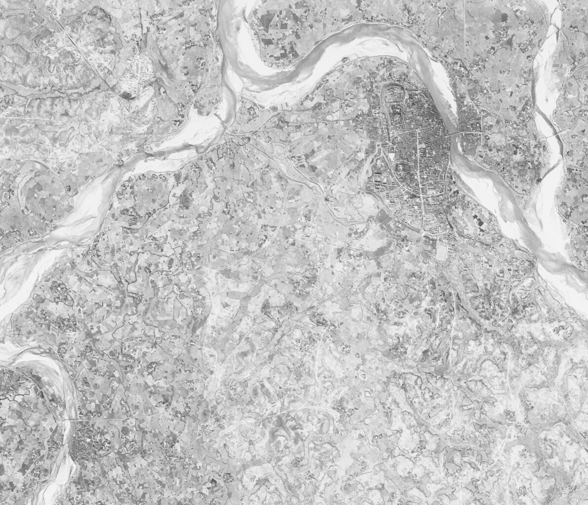
中文(中国大陆):一张同时包含抚州(地图东北部)、抚北(地图西北部)与上顿渡(地图西南部)的摄于1968年的卫星图。
如今,抚州成为了抚州市的主城区、抚北成为了工业园区、上顿渡成为了临川区的行政中心。
English: Satellite map from 1968 showing Fuzhou (north-eastern part of the map), Fubei (north-western part of the map) and Shangdongdu (south-western part of the map).
Today, Fuzhou is the main city of Fuzhou, Fubei is an industrial park, and Shangdongdu is the administrative centre of Linchuan District. |
| 日期 | |
| 来源 | https://earthexplorer.usgs.gov/ |
| 作者 | United States Geological Survey |
许可协议
|
|
文件历史
点击某个日期/时间查看对应时刻的文件。
| 日期/时间 | 缩略图 | 大小 | 用户 | 备注 | |
|---|---|---|---|---|---|
| 当前 | 2023年10月9日 (一) 15:29 |  | 5,712 × 4,912(26.76 MB) | CandyDada | Uploaded a work by United States Geological Survey from https://earthexplorer.usgs.gov/ with UploadWizard |
文件用途
以下2个页面使用本文件: