File:19th Kum River Map2.JPG
本预览的尺寸:768 × 600像素。 其他分辨率:308 × 240像素 | 615 × 480像素 | 984 × 768像素 | 1,280 × 999像素 | 1,500 × 1,171像素。
原始文件 (1,500 × 1,171像素,文件大小:506 KB,MIME类型:image/jpeg)
摘要
| 描述 |
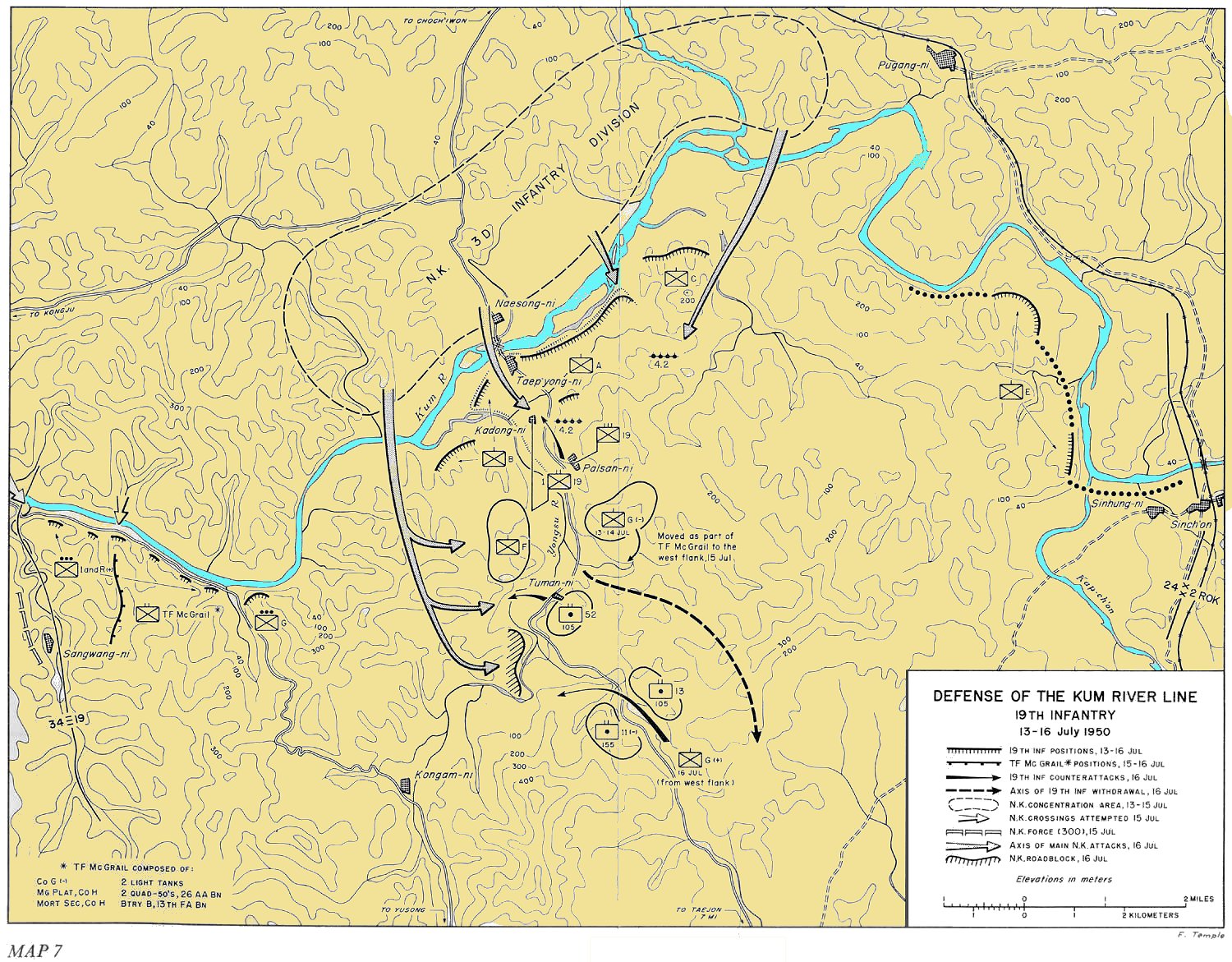
English: Defense of the Kum River Line, 19th Infantry - 13-16 July 1950 |
| 日期 | |
| 来源 | http://www.koreanwar.org/html/korean_war_maps_results.html?map_url=SNK_MAP_7_1500W, map as originally published in South to the Naktong, North to the Yalu by Roy Appleman, US Army historian (1992) |
| 作者 | Center of Military History, United States Army |
许可协议
|
|
 |
文件历史
点击某个日期/时间查看对应时刻的文件。
| 日期/时间 | 缩略图 | 大小 | 用户 | 备注 | |
|---|---|---|---|---|---|
| 当前 | 2010年4月9日 (五) 07:38 | | 1,500 × 1,171(506 KB) | Ling.Nut | Trivially changed to add color. == Licensing == {{PD-USGov-Military-Army}} |
文件用途
以下页面使用本文件:
全域文件用途
以下其他wiki使用此文件:
- de.wikipedia.org上的用途
- en.wikipedia.org上的用途
- es.wikipedia.org上的用途
- fr.wikipedia.org上的用途
- it.wikipedia.org上的用途
- ja.wikipedia.org上的用途
- ko.wikipedia.org上的用途
- pt.wikipedia.org上的用途