File:Angkor1866.jpg
本预览的尺寸:772 × 600像素。 其他分辨率:309 × 240像素 | 618 × 480像素 | 989 × 768像素 | 1,280 × 995像素 | 1,390 × 1,080像素。
原始文件 (1,390 × 1,080像素,文件大小:1.6 MB,MIME类型:image/jpeg)
| 相机位置 | | 在以下服务上查看本图像和附近其他图像: OpenStreetMap |
|---|
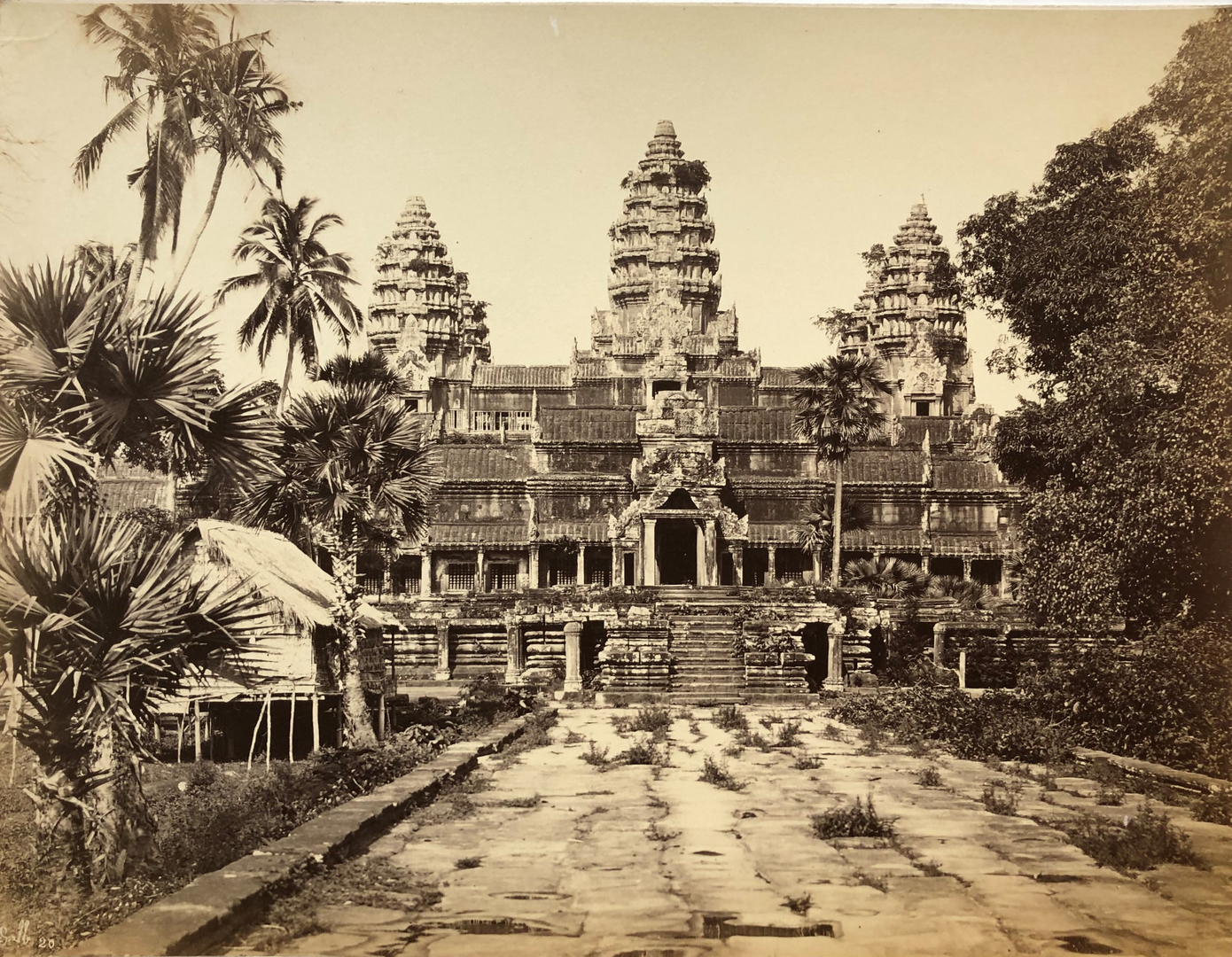
Angkor Wat photographed in 1866 by Emile Gsell (1838-1879). Taken from [1]. The page has a copyright tag, but it's not clear whether they intend the tag to apply to the photo as well as the text; I think it's fair to assume that Gsell's work is now PD. Markalexander100 08:33, 25 Jun 2005 (UTC)
|
本作品在其来源国以及其他著作权期限是作者逝世后70年或以下的国家和地区属于公有领域。 | |
| 本文件已被确认为免除已知的著作权法限制(包括所有相关权利)。 | |
文件历史
点击某个日期/时间查看对应时刻的文件。
| 日期/时间 | 缩略图 | 大小 | 用户 | 备注 | |
|---|---|---|---|---|---|
| 当前 | 2021年8月8日 (日) 16:15 | | 1,390 × 1,080(1.6 MB) | Nesnad | better resolution |
| 2005年6月25日 (六) 08:33 |  | 450 × 347(54 KB) | Markalexander100 | {{PD}} Angkor Wat photographed in 1866 by Emile Gsell (1838-1879). Taken from [http://www.diplomatie.gouv.fr/archives/dossiers/patrimoine2003/angkor_6.html]. The page has a copyright tag, but it's not clear whether they intend the tag to apply to the p |
文件用途
以下页面使用本文件:
全域文件用途
以下其他wiki使用此文件:
- ar.wikipedia.org上的用途
- arz.wikipedia.org上的用途
- bn.wikipedia.org上的用途
- ca.wikipedia.org上的用途
- cs.wikipedia.org上的用途
- da.wikipedia.org上的用途
- de.wikipedia.org上的用途
- en.wikipedia.org上的用途
- eo.wikipedia.org上的用途
- fa.wikipedia.org上的用途
- fi.wikipedia.org上的用途
- fr.wikipedia.org上的用途
- fr.wikibooks.org上的用途
- hr.wikipedia.org上的用途
- hu.wikipedia.org上的用途
- ja.wikipedia.org上的用途
- kn.wikipedia.org上的用途
- la.wikipedia.org上的用途
- mk.wikipedia.org上的用途
- ml.wikipedia.org上的用途
- nn.wikipedia.org上的用途
- no.wikipedia.org上的用途
- oc.wikipedia.org上的用途
- ro.wikipedia.org上的用途
- ru.wikipedia.org上的用途
- sh.wikipedia.org上的用途
- th.wikipedia.org上的用途
- tt.wikipedia.org上的用途
- uk.wikipedia.org上的用途
- vi.wikipedia.org上的用途