File:Asturias location map.svg

此SVG文件的PNG预览的大小:512 × 378像素。 其他分辨率:320 × 236像素 | 640 × 473像素 | 1,024 × 756像素 | 1,280 × 945像素 | 2,560 × 1,890像素。
原始文件 (SVG文件,尺寸为512 × 378像素,文件大小:158 KB)
| 描述 |
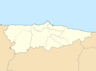
English: Location map of Asturias Equirectangular projection, N/S stretching 130 %. Geographic limits of the map: * N: 44.141° N * S: 42.498° N * W: 7.286° O * E: 4.375° O Español: Mapa de localización de Asturias Proyección equirrectangular, N/S estirada 130 %. Límites geográficos del mapa: * N: 44.141° N * S: 42.498° N * W: 7.286° O * E: 4.375° O |
| 日期 | (UTC) |
| 来源 | |
| 作者 |
|
| 其他版本 | Derivative works of this file: Circunscripciones electorales Asturias.svg |
| 这是一张修改过的图片,这意味着它已在原版本的基础上通过软件进行了编辑,改动内容:harmonisation des couleurs。其原始版本为:Asturias-loc.svg。
|
我,本作品著作权人,特此采用以下许可协议发表本作品:
本文件采用知识共享署名-相同方式共享 3.0 未本地化版本许可协议授权。
- 您可以自由地:
- 共享 – 复制、发行并传播本作品
- 修改 – 改编作品
- 惟须遵守下列条件:
- 署名 – 您必须对作品进行署名,提供授权条款的链接,并说明是否对原始内容进行了更改。您可以用任何合理的方式来署名,但不得以任何方式表明许可人认可您或您的使用。
- 相同方式共享 – 如果您再混合、转换或者基于本作品进行创作,您必须以与原先许可协议相同或相兼容的许可协议分发您贡献的作品。
原始上传日志
This image is a derivative work of the following images:
- File:Asturias-loc.svg licensed with Cc-by-sa-3.0
- 2010-05-07T11:44:07Z Miguillen 512x378 (272467 Bytes) {{Information |Description=Mapa delocalización del Principado de Asturias |Source={{own}} |Date=2009-05-07 |Author=[[User:Miguillen|Miguillen]] |Permission= |other_versions= }} [[Category:Maps of Asturias]]
Uploaded with derivativeFX
文件历史
点击某个日期/时间查看对应时刻的文件。
| 日期/时间 | 缩略图 | 大小 | 用户 | 备注 | |
|---|---|---|---|---|---|
| 当前 | 2010年5月19日 (三) 11:07 | | 512 × 378(158 KB) | Miguillen | borde de costa |
| 2010年5月18日 (二) 09:49 |  | 512 × 378(144 KB) | Xfigpower | {{Information |Description={{en|Location map of Asturias}} Equirectangular projection, N/S stretching 130 %. Geographic limits of the map: * N: 44.141° N * S: 42.498° N * W: 7.286° O * E: 4.375° O {{es|Mapa de localización de [ |
文件用途
以下2个页面使用本文件:
全域文件用途
以下其他wiki使用此文件:
- ast.wikipedia.org上的用途
- Xixón
- Castiello Bernueces (parroquia)
- Valdornón
- Cabueñes
- Caldones (parroquia)
- L'Abadía Cenero
- Deva (parroquia)
- Fano (parroquia)
- Fresno (parroquia)
- Granda (Xixón)
- Samartín de Güerces
- Llavandera (parroquia)
- Llorio
- La Pedrera (parroquia)
- Porceyo
- Puao
- Roces (Xixón)
- Ruedes (parroquia)
- Santurio
- Serín
- Somió
- San Andrés de los Tacones
- Vega (Xixón)
- Veriña
- Xove
- Naves (parroquia de Llanes)
- Cecos
- Santolaya de Vixil
- Zardaín
- Navelgas
- Santolaya de Miñu
- La Puela (parroquia)
- Caborana (parroquia)
- Uxo (parroquia)
- Celoriu (Llanes)
- Universidá d'Uviéu
- Ríu Nalón
- Blimea (parroquia)
- Santa Bárbola
- Bisuyu (Allande)
- Bustantigo (parroquia)
- San Andrés (Trubia)
- Lliberdón (parroquia)
- Cuadonga
- Llastres (parroquia)
- Berducedo (parroquia)
- Llago (parroquia)
- Ḷḷinares (parroquia d'Allande)
- Ḷḷomes (parroquia)
- Paraxes (parroquia)
查看本文件的更多全域用途。