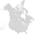
File:BlankMap-USA-states-Canada-provinces, HI closer.svg

此SVG文件的PNG预览的大小:512 × 512像素。 其他分辨率:240 × 240像素 | 480 × 480像素 | 768 × 768像素 | 1,024 × 1,024像素 | 2,048 × 2,048像素。
原始文件 (SVG文件,尺寸为512 × 512像素,文件大小:104 KB)
文件历史
点击某个日期/时间查看对应时刻的文件。
| 日期/时间 | 缩略图 | 大小 | 用户 | 备注 | |
|---|---|---|---|---|---|
| 当前 | 2020年11月23日 (一) 01:48 |  | 512 × 512(104 KB) | Ponderosapine210 | Accidentally uploaded wrong version. Here is the correct one. |
| 2020年11月23日 (一) 01:38 |  | 512 × 596(132 KB) | Ponderosapine210 | Added the prominent islands of Manitoulin (Ontario) and Isle Royale (Michigan) to the Great Lakes. | |
| 2019年6月1日 (六) 22:59 |  | 512 × 512(99 KB) | Fluffy89502 | added territories | |
| 2007年12月8日 (六) 21:18 |  | 1,730 × 1,730(212 KB) | Lokal Profil | Code trimming | |
| 2007年7月3日 (二) 04:21 |  | 1,730 × 1,730(213 KB) | Lokal Profil | {{Information |Description={{en|Blank SVG map of USA and Canada with state and province borders. Hawaii has been moved closer to the mainland USA to reduce width of image.}} Non-contiguous parts of a states/provinces are "grouped" together with the main a |
文件用途
没有页面使用本文件。
全域文件用途
以下其他wiki使用此文件:
- en.wikipedia.org上的用途
- fr.wikipedia.org上的用途
