File:Bombay 1909.jpg
本预览的尺寸:448 × 600像素。 其他分辨率:179 × 240像素 | 358 × 480像素 | 573 × 768像素 | 764 × 1,024像素 | 1,571 × 2,104像素。
原始文件 (1,571 × 2,104像素,文件大小:385 KB,MIME类型:image/jpeg)
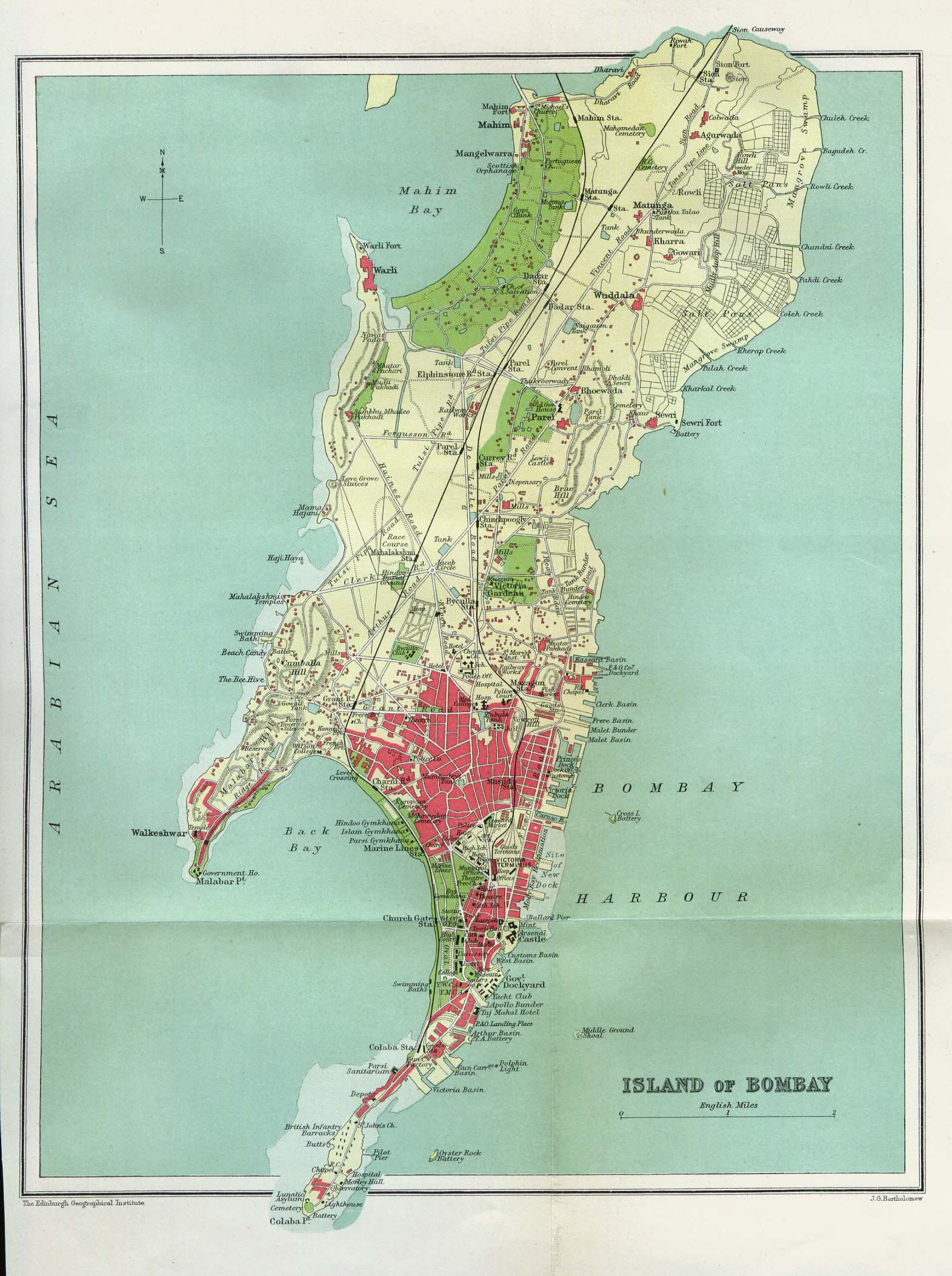
| 描述 | Island of Bombay (map) |
| 日期 | |
| 来源 | The Gazetteer of Bombay City and Island. Volume 1. Bombay, India 1909 |
| 作者 | J.G. Bartholomew, The Edinburgh Geographical Institute |
|
本作品在其来源国以及其他著作权期限是作者逝世后70年或以下的国家和地区属于公有领域。 | |
| 本文件已被确认为免除已知的著作权法限制(包括所有相关权利)。 | |
| Open this image as an overlay in Google Earth (Google Maps, Bing) | (Help|Source) |
文件历史
点击某个日期/时间查看对应时刻的文件。
| 日期/时间 | 缩略图 | 大小 | 用户 | 备注 | |
|---|---|---|---|---|---|
| 当前 | 2008年12月26日 (五) 02:17 | | 1,571 × 2,104(385 KB) | Gobeirne | {{Information |Description=Island of Bombay (map) |Source=The Gazetteer of Bombay City and Island. Volume 1. Bombay, India 1909 |Date=1909 |Author=J.G. Bartholomew, The Edinburgh Geographical Institute |Permission=See below. |other_versions= }} {{PD-old}} |
文件用途
以下页面使用本文件:
全域文件用途
以下其他wiki使用此文件:
- en.wikipedia.org上的用途
- fr.wikipedia.org上的用途
- nn.wikipedia.org上的用途
- no.wikipedia.org上的用途
- or.wikipedia.org上的用途
- sv.wikipedia.org上的用途
- ta.wikipedia.org上的用途