File:Brindas.jpg
此为最大尺寸。
Brindas.jpg (564 × 368像素,文件大小:33 KB,MIME类型:image/jpeg)
摘要
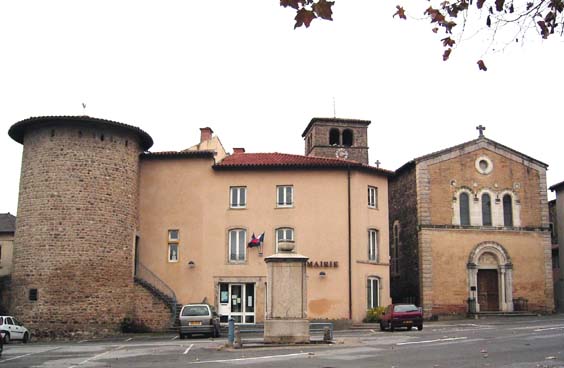
| 描述 | Vue de la place de Brindas : tour, mairie, église... (Photo "standard" sur laquelle j'abandonne tout droit) |
| 日期 | 2006年1月5日 (原始上传日期) |
| 来源 | Transferred from fr.wikipedia to Commons. |
| 作者 | 法语维基百科的Doctor-sd |
| 授权 (二次使用本文件) |
DP; This image is in the public domain. |
| 物体位置 | | 在以下服务上查看本图像和附近其他图像: OpenStreetMap |
|---|
|
This building is inscrit au titre des monuments historiques de la France. It is indexed in the base Mérimée, a database of architectural heritage maintained by the French Ministry of Culture, under the reference PA00117727
|
许可协议
| |
本作品已被作者中文维基百科项目的Doctor-sd释出到公有领域。这适用于全世界。 如果这样做不合法的话: |
原始上传日志
The original description page was here. All following user names refer to fr.wikipedia.
- 2006-01-05 14:21 Doctor-sd 564×368×8 (33531 bytes) Vue de la place de Brindas : tour, mairie, église... (Photo "standard" sur laquelle j'abandonne tout droit)
文件历史
点击某个日期/时间查看对应时刻的文件。
| 日期/时间 | 缩略图 | 大小 | 用户 | 备注 | |
|---|---|---|---|---|---|
| 当前 | 2007年5月11日 (五) 07:52 | | 564 × 368(33 KB) | Touriste | {{Information |Description=Vue de la place de Brindas : tour, mairie, église... (Photo "standard" sur laquelle j'abandonne tout droit) |Source=Originally from [http://fr.wikipedia.org fr.wikipedia]; description page is/was [http://fr.wikipedia.org/w/inde |
文件用途
以下页面使用本文件:
全域文件用途
以下其他wiki使用此文件:
- ast.wikipedia.org上的用途
- ca.wikipedia.org上的用途
- ceb.wikipedia.org上的用途
- ce.wikipedia.org上的用途
- de.wikipedia.org上的用途
- en.wikipedia.org上的用途
- es.wikipedia.org上的用途
- eu.wikipedia.org上的用途
- fr.wikipedia.org上的用途
- hu.wikipedia.org上的用途
- it.wikipedia.org上的用途
- la.wikipedia.org上的用途
- lld.wikipedia.org上的用途
- lmo.wikipedia.org上的用途
- ms.wikipedia.org上的用途
- nl.wikipedia.org上的用途
- oc.wikipedia.org上的用途
- pl.wikipedia.org上的用途
- pt.wikipedia.org上的用途
- ro.wikipedia.org上的用途
- sh.wikipedia.org上的用途
- sk.wikipedia.org上的用途
- sr.wikipedia.org上的用途
- sv.wikipedia.org上的用途
- tt.wikipedia.org上的用途
- uk.wikipedia.org上的用途
- uz.wikipedia.org上的用途
- vec.wikipedia.org上的用途
- vo.wikipedia.org上的用途
- www.wikidata.org上的用途
- zh-min-nan.wikipedia.org上的用途