File:China.TMO2002163 lrg.jpg

原始文件 (2,600 × 2,000像素,文件大小:967 KB,MIME类型:image/jpeg)
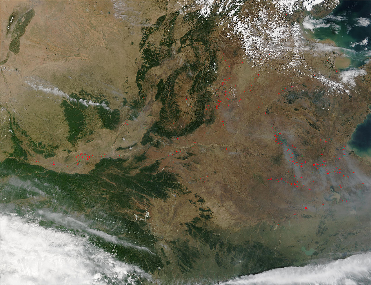
Pollution over Eastern China 華北/華東的空氣污染
Credit: Jacques Descloitres, MODIS Rapid Response Team, NASA/GSFC
On June 12, 2002, the Moderate Resolution Imaging Spectroradiometer (MODIS) on the Terra satellite captured this image of eastern China, showing numerous fires (red dots) and haze, probably a combination of smoke and urban pollution.
The Huang He (Yellow River) enters the image at top center and flows southward just to the west of the forested mountains. In roughly the center of the image, the Huang He veers sharply eastward and flows northeastward out to the bay known as Bo Hai.
Please note that the high-resolution scene provided here is 500 meters per pixel. For a copy of the scene at the sensor's fullest resolution, visit the MODIS Rapid Response Image Gallery.
照片來源:美國國家航空暨太空總署 Jacques Descloitres
這幅圖像是由美國航空航天署的衛星在2002年6月12日拍攝的.圖像顯示了分散各地的無數個著火處(小紅圈表示)以及很可能是他們引生的霧霾.
參見:中國的空氣污染
| 本文件完全由NASA创作,在美国属于公有领域。根据NASA的版权方针,NASA的材料除非另有声明否则不受版权保护。(参见Template:PD-USGov/zh、NASA版权方针页面或JPL图片使用方针。) | ||
 |
警告:
|
文件历史
点击某个日期/时间查看对应时刻的文件。
| 日期/时间 | 缩略图 | 大小 | 用户 | 备注 | |
|---|---|---|---|---|---|
| 当前 | 2005年3月20日 (日) 04:42 | | 2,600 × 2,000(967 KB) | R.O.C | Pollution over Eastern China 華北/華東的空氣污染 |
文件用途
以下页面使用本文件: