File:Eurasian steppe belt.jpg
本预览的尺寸:800 × 597像素。 其他分辨率:320 × 239像素 | 640 × 478像素 | 1,024 × 765像素 | 1,280 × 956像素 | 2,048 × 1,529像素。
原始文件 (2,048 × 1,529像素,文件大小:1.62 MB,MIME类型:image/jpeg)
摘要
| 描述 |
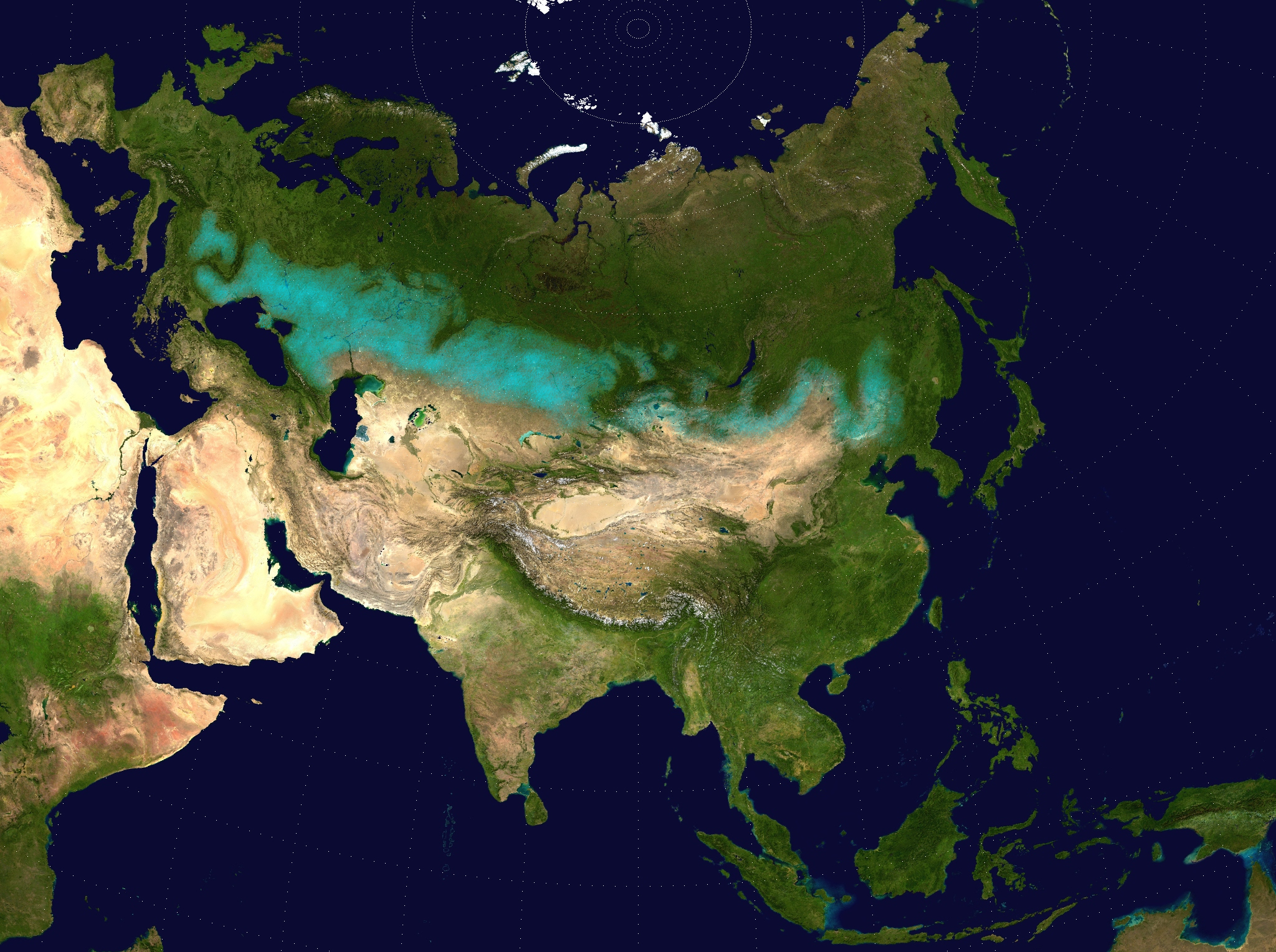
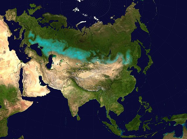
English: Approximate extent of the Eurasian Steppe grasslands ecoregion, and Eurasia cultural region.
|
| 日期 | (UTC) |
| 来源 | |
| 作者 |
|
| 授权 (二次使用本文件) |
Source map released into public domain. |
| 这是一张修改过的图片,这意味着它已在原版本的基础上通过软件进行了编辑,改动内容:Eurasian Steppe highlighted in ; areas of Caspian Sea and Lake Balkhash converted to to avoid confusion; image cropped.。其原始版本为:Two-point-equidistant-asia.jpg。
|
许可协议
我,本作品著作权人,特此采用以下许可协议发表本作品:
| 我,本作品著作权人,释出本作品至公有领域。这适用于全世界。 在一些国家这可能不合法;如果是这样的话,那么: 我无条件地授予任何人以任何目的使用本作品的权利,除非这些条件是法律规定所必需的。 |
文件历史
点击某个日期/时间查看对应时刻的文件。
| 日期/时间 | 缩略图 | 大小 | 用户 | 备注 | |
|---|---|---|---|---|---|
| 当前 | 2017年4月6日 (四) 17:24 | | 2,048 × 1,529(1.62 MB) | Clivius | The area was adjusted in accordance with the actual geographic location. |
| 2016年6月10日 (五) 00:48 |  | 1,640 × 1,320(296 KB) | Shattered Gnome | New coloration of source image; DarkPink highlight is now Cyan. Somewhat cropped. | |
| 2009年5月26日 (二) 14:37 |  | 2,048 × 1,529(1.64 MB) | Cp6 | {{Information |Description=Approximate pathway of the Eurasian steppe belt. Based on file Two-point-equidistant-asia, see below. |Source=*File:Two-point-equidistant-asia.jpg |Date=2009-05-26 15:24 (UTC) |Author=*[[:File:Two-point-equidistant-asia.j |
文件用途
全域文件用途
以下其他wiki使用此文件:
- ar.wikipedia.org上的用途
- azb.wikipedia.org上的用途
- az.wikipedia.org上的用途
- ba.wikipedia.org上的用途
- be-tarask.wikipedia.org上的用途
- be.wikipedia.org上的用途
- bg.wikipedia.org上的用途
- bh.wikipedia.org上的用途
- bn.wikipedia.org上的用途
- ca.wikipedia.org上的用途
- cs.wikipedia.org上的用途
- cy.wikipedia.org上的用途
- de.wikipedia.org上的用途
- de.wikibooks.org上的用途
- de.wikiversity.org上的用途
- el.wikipedia.org上的用途
- en.wikipedia.org上的用途
- eo.wikipedia.org上的用途
- es.wikipedia.org上的用途
- eu.wikipedia.org上的用途
- fa.wikipedia.org上的用途
- fa.wikibooks.org上的用途
- fi.wikipedia.org上的用途
- frr.wikipedia.org上的用途
- fr.wikivoyage.org上的用途
- ga.wikipedia.org上的用途
- glk.wikipedia.org上的用途
- he.wikipedia.org上的用途
- hi.wikipedia.org上的用途
- hr.wikipedia.org上的用途
- hu.wikipedia.org上的用途
- hy.wikipedia.org上的用途
查看本文件的更多全域用途。