File:Gander International Airport (satellite view).jpg
本预览的尺寸:799 × 600像素。 其他分辨率:320 × 240像素 | 640 × 480像素 | 806 × 605像素。
原始文件 (806 × 605像素,文件大小:76 KB,MIME类型:image/jpeg)
.jpg?uselang=zh-cn)
.jpg?uselang=zh-cn)
.jpg?action=history&uselang=zh-cn)
.jpg)
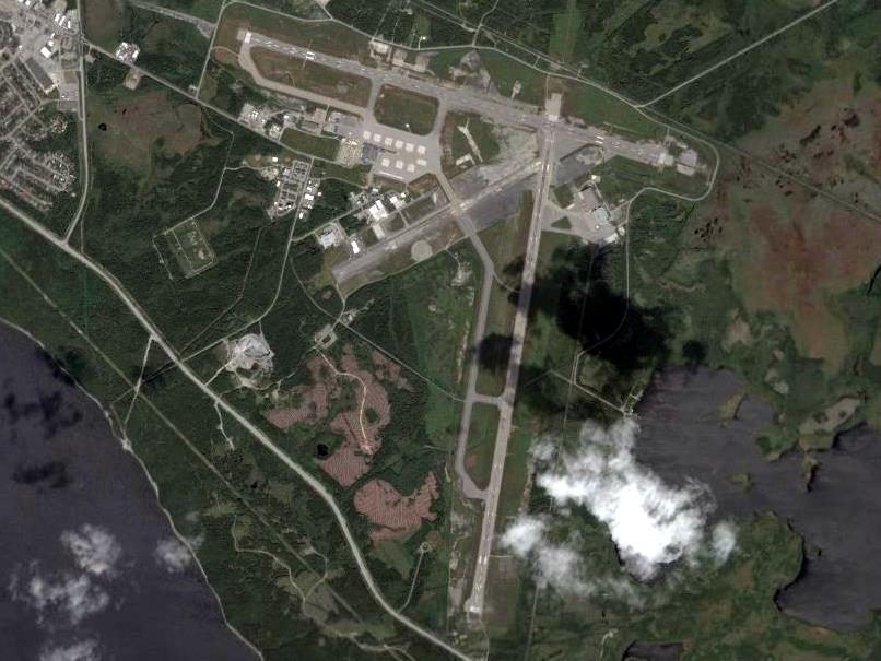
| 描述 | Gander International Airport |
| 来源 | NASA |
| 作者 | NASA World Wind |
NASA World Wind - screenshot from version 1.4.0
| 本图像属于 w:公有领域 ,因其为 NASA 的 World Wind 卫星地图浏览器的一张截图,且使用了公有领域图层,如 Blue Marble、MODIS、Landsat、SRTM、USGS、GLOBE 等。
|
 |
文件历史
点击某个日期/时间查看对应时刻的文件。
| 日期/时间 | 缩略图 | 大小 | 用户 | 备注 | |
|---|---|---|---|---|---|
| 当前 | 2007年11月29日 (四) 15:22 | | 806 × 605(76 KB) | SMaloney | {{Information |Description=Gander International Airport |Source=NASA |Date= |Author=NASA World Wind |Permission= |other_versions= }} NASA World Wind - screenshot from version 1.4.0<br /> {{PD-WorldWind}} |
文件用途
全域文件用途
以下其他wiki使用此文件:
- ar.wikipedia.org上的用途
- ceb.wikipedia.org上的用途
- de.wikipedia.org上的用途
- de.wikivoyage.org上的用途
- en.wikipedia.org上的用途
- en.wikivoyage.org上的用途
- es.wikipedia.org上的用途
- eu.wikipedia.org上的用途
- fa.wikipedia.org上的用途
- fi.wikipedia.org上的用途
- fr.wikipedia.org上的用途
- fr.wikivoyage.org上的用途
- gl.wikipedia.org上的用途
- hu.wikipedia.org上的用途
- it.wikipedia.org上的用途
- ja.wikipedia.org上的用途
- ko.wikipedia.org上的用途
- nl.wikipedia.org上的用途
- pl.wikipedia.org上的用途
- ru.wikipedia.org上的用途
- sv.wikipedia.org上的用途
- tg.wikipedia.org上的用途
- uk.wikipedia.org上的用途
- www.wikidata.org上的用途
.jpg)