File:Honduras rel 1985.jpg

本预览的尺寸:743 × 600像素。 其他分辨率:297 × 240像素 | 595 × 480像素 | 952 × 768像素 | 1,188 × 959像素。
原始文件 (1,188 × 959像素,文件大小:240 KB,MIME类型:image/jpeg)
摘要
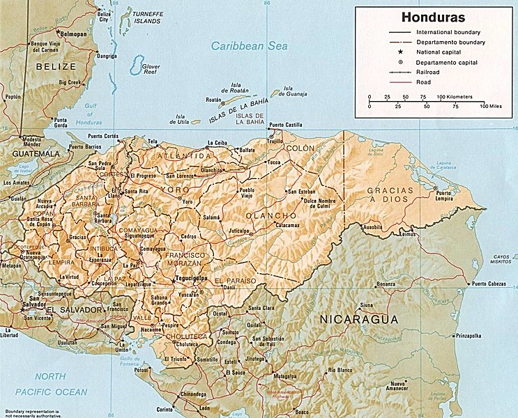
| 描述 | Shaded relief map of Honduras, in year 1985, showing more than 45 Honduras towns, plus 40 bordering towns, in original JPEG format, 1249 x 1033 pixel, 246kb (labeled for large resizing > 600px width). |
| 日期 | Uploaded 28-October-2005 |
| 来源 | Image source URL: http://www.lib.utexas.edu/maps/americas/honduras.jpg; there was no copyright restriction on the containing webpage of the UT Library: UT Perry-Castañeda Library Map Collection - Honduras Maps. |
| 作者 | US CIA (archived by UT Library) |
| 其他版本 | (none yet) |
许可协议
| 本图像是中央情报局雇员的职务作品。作为美国联邦政府的作品,本图像或媒体属于公有领域。
|

|
-
文件历史
点击某个日期/时间查看对应时刻的文件。
| 日期/时间 | 缩略图 | 大小 | 用户 | 备注 | |
|---|---|---|---|---|---|
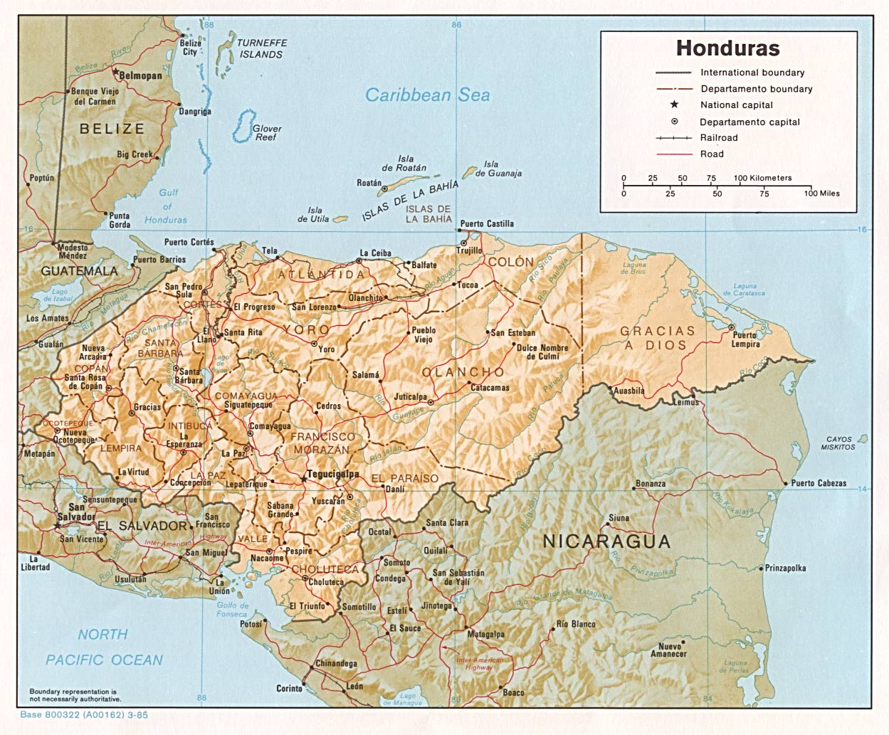
| 当前 | 2017年10月3日 (二) 07:08 | | 1,188 × 959(240 KB) | ديفيد عادل وهبة خليل 2 | Removed border by cropping 5 % horizontally and 7 % vertically using CropTool with precise mode. |
| 2005年10月28日 (五) 00:52 |  | 1,249 × 1,033(246 KB) | Brian0918 | Shaded relief map of Honduras, 1985. http://www.lib.utexas.edu/maps/honduras.html {{PD-USGov-CIA}} Category:Maps of Honduras |
文件用途
以下页面使用本文件:
全域文件用途
以下其他wiki使用此文件:
- arz.wikipedia.org上的用途
- ast.wikipedia.org上的用途
- ba.wikipedia.org上的用途
- ca.wikipedia.org上的用途
- el.wikipedia.org上的用途
- en.wikipedia.org上的用途
- es.wikipedia.org上的用途
- fa.wikipedia.org上的用途
- fr.wikipedia.org上的用途
- gd.wikipedia.org上的用途
- gu.wikipedia.org上的用途
- hu.wikipedia.org上的用途
- hy.wikipedia.org上的用途
- id.wikipedia.org上的用途
- ilo.wikipedia.org上的用途
- io.wikipedia.org上的用途
- is.wikipedia.org上的用途
- it.wikipedia.org上的用途
- ja.wikipedia.org上的用途
- kk.wikipedia.org上的用途
- la.wikipedia.org上的用途
- lv.wikipedia.org上的用途
- mk.wikipedia.org上的用途
- mt.wikipedia.org上的用途
- os.wikipedia.org上的用途
- pa.wikipedia.org上的用途
- pnb.wikipedia.org上的用途
- pt.wikipedia.org上的用途
- ru.wikipedia.org上的用途
- sh.wikipedia.org上的用途
- sl.wikipedia.org上的用途
- sq.wikipedia.org上的用途
- sr.wikipedia.org上的用途
- ta.wikipedia.org上的用途
- te.wikipedia.org上的用途
- th.wikipedia.org上的用途
- tr.wikipedia.org上的用途
- uk.wikipedia.org上的用途
查看本文件的更多全域用途。