File:Insurance Plan of City of London Vol. I; sheet 23 (BL 150118).tiff

此TIF文件的JPG预览的大小:513 × 600像素。 其他分辨率:205 × 240像素 | 411 × 480像素 | 657 × 768像素 | 876 × 1,024像素 | 1,752 × 2,048像素 | 3,159 × 3,693像素。
原始文件 (3,159 × 3,693像素,文件大小:33.38 MB,MIME类型:image/tiff)
摘要
许可协议
|
本作品在其来源国以及其他著作权期限是作者逝世后100年或以下的国家和地区属于公有领域。 | |
| 本文件已被确认为免除已知的著作权法限制(包括所有相关权利)。 | |
文件历史
点击某个日期/时间查看对应时刻的文件。
| 日期/时间 | 缩略图 | 大小 | 用户 | 备注 | |
|---|---|---|---|---|---|
| 当前 | 2017年3月24日 (五) 18:39 | 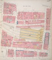 | 3,159 × 3,693(33.38 MB) | Fæ | British Library Fire insurance maps, #313, http://www.bl.uk/onlinegallery/onlineex/firemaps/england/london/itov/mapsu145ubu22u1uf023r.html |
文件用途
以下页面使用本文件:
全域文件用途
以下其他wiki使用此文件:
- bn.wikipedia.org上的用途
- en.wikipedia.org上的用途
- nl.wikipedia.org上的用途