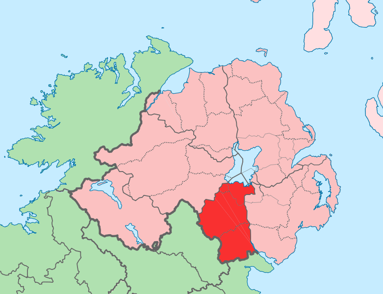
File:Island of Ireland location map Armagh.svg

此SVG文件的PNG预览的大小:781 × 600像素。 其他分辨率:313 × 240像素 | 625 × 480像素 | 1,001 × 768像素 | 1,280 × 983像素 | 2,560 × 1,965像素 | 934 × 717像素。
原始文件 (SVG文件,尺寸为934 × 717像素,文件大小:828 KB)
文件历史
点击某个日期/时间查看对应时刻的文件。
| 日期/时间 | 缩略图 | 大小 | 用户 | 备注 | |
|---|---|---|---|---|---|
| 当前 | 2010年7月19日 (一) 12:22 |  | 934 × 717(828 KB) | Mabuska | Reverted to version as of 11:54, 19 July 2010 |
| 2010年7月19日 (一) 12:21 |  | 931 × 701(826 KB) | Mabuska | fixing attempt | |
| 2010年7月19日 (一) 12:05 |  | 930 × 700(826 KB) | Mabuska | fixing attempt | |
| 2010年7月19日 (一) 11:58 |  | 934 × 717(830 KB) | Mabuska | boundary fix | |
| 2010年7月19日 (一) 11:54 |  | 934 × 717(828 KB) | Mabuska | {{Information |Description={{en|The island of Ireland, showing international border between Northern Ireland and Republic of Ireland, traditional provinces, traditional counties, and local authority areas in the Republic of Ireland and Northern Ireland.}} |
文件用途
以下页面使用本文件:
全域文件用途
以下其他wiki使用此文件:
- bg.wikipedia.org上的用途
- cs.wikipedia.org上的用途
- de.wikipedia.org上的用途
- en.wikipedia.org上的用途
- es.wikipedia.org上的用途
- eu.wikipedia.org上的用途
- Armagh
- Portadown
- Newry
- Lankide:Euskaldunaa
- Lurgan
- Craigavon
- Armagh konderria
- Txantiloi:Armagh konderriko udalerriak
- Acton (Armagh konderria)
- Aghacommon
- Annaghmore (Armagh konderria)
- Annahugh
- Ardress (Armagh konderria)
- Aughanduff
- Ballydugan
- Ballymacnab
- Bannfoot
- Belleeks
- Bessbrook
- Blackwatertown
- Broomhill (Armagh konderria)
- Camlough
- Carrickaness
- Charlemont (Armagh konderria)
- Cladymore
- Clonmore (Armagh konderria)
- Collegeland (Armagh konderria)
- Corrinshego
- Creeveroe
- Creggan (Armagh konderria)
- Crossmaglen
- Cullaville
- Cullyhanna
- Darkley
- Derryadd
- Derrycrew
- Derrymacash
- Derryhale
- Derrynoose
- Derrytrasna
- Dorsey (Armagh konderria)
- Drumnacanvy
查看此文件的更多全域用途。
