File:Jerusalem-Compiled, drawn and printed by the Survey of Palestine-1.jpg

本预览的尺寸:551 × 600像素。 其他分辨率:220 × 240像素 | 441 × 480像素 | 705 × 768像素 | 940 × 1,024像素 | 2,365 × 2,575像素。
原始文件 (2,365 × 2,575像素,文件大小:1.33 MB,MIME类型:image/jpeg)
摘要
| 描述 |
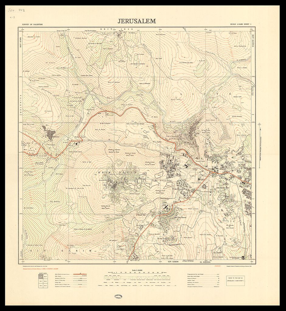
English: An accurate topographic map of Jerusalem in six sheets. Produced by the Survey of Palestine, 1945-1946.
עברית: מפה טופוגרפית מדויקת של ירושלים, בששה גליונות, חוברה על ידי מחלקת המדידות של ממשלת המנדט , 1945-1946
Dimensions:52 X 52 cm Click to enlarge |
|||
| 日期 | ||||
| 来源 | The Eran Laor Cartographic Collection, National Library of Israel | |||
| 作者 | The National Library of Israel | |||
| 其他版本 |


.jpg)
许可协议
|
本作品在其来源国以及其他著作权期限是作者逝世后70年或以下的国家和地区属于公有领域。 | |
| 本文件已被确认为免除已知的著作权法限制(包括所有相关权利)。 | |
文件历史
点击某个日期/时间查看对应时刻的文件。
| 日期/时间 | 缩略图 | 大小 | 用户 | 备注 | |
|---|---|---|---|---|---|
| 当前 | 2015年12月10日 (四) 14:18 | | 2,365 × 2,575(1.33 MB) | National Library of Israel |
文件用途
以下页面使用本文件:
全域文件用途
以下其他wiki使用此文件:
- ar.wikipedia.org上的用途
- en.wikipedia.org上的用途
- es.wikipedia.org上的用途
- fa.wikipedia.org上的用途
- hy.wikipedia.org上的用途