File:King John's campaign 1215-6.png
本预览的尺寸:458 × 600像素。 其他分辨率:183 × 240像素 | 366 × 480像素 | 781 × 1,023像素。
原始文件 (781 × 1,023像素,文件大小:165 KB,MIME类型:image/png)
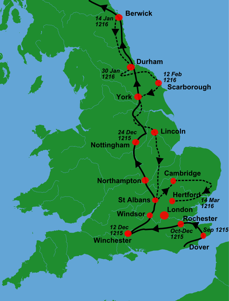
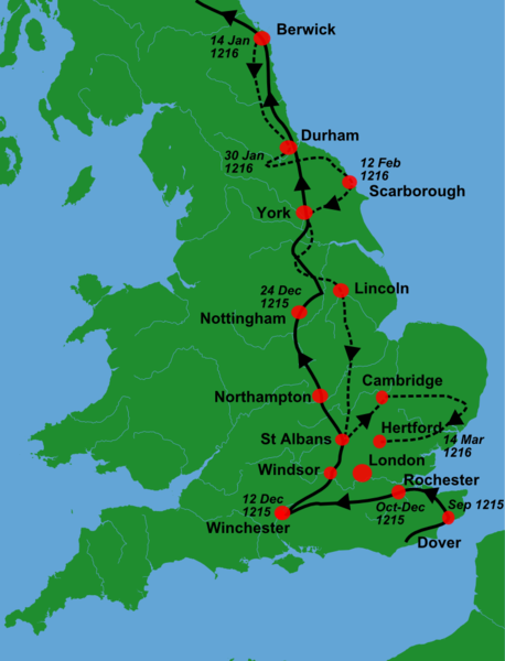
| 描述 | A blank locator map for Great Britain, with King John's 1216-6 military campaigns superimposed on it (using information from Warren, "King John", p. 250. The idea is to superimpose Image:dot4gb.svg at the appropriate point. See w:Template:GBthumb for code to do this. These two images can replace any locator map posted by Lupin - see w:Special:Contributions/LupinBot. This is a vectorized version of Image:Gb4dot.png, with the scale changed from 200 km to 150 km/150 miles. The shoreline data come from the file gshhs_h.b from the GSHHS, and the rivers and the Irish border come from the CIA World DataBank II; both sources are in the public domain. Mercator projection. == |
| 日期 | (UTC) |
| 来源 |
个人作品,使用:
|
| 作者 |
|
| 这是一张修改过的图片,这意味着它已在原版本的基础上通过软件进行了编辑,改动内容:Trimmed, campaign superimposed。其原始版本为:Gb4dot.svg。修改者: Hchc2009。
|
我,本作品著作权人,特此采用以下许可协议发表本作品:
| 我,本作品著作权人,释出本作品至公有领域。这适用于全世界。 在一些国家这可能不合法;如果是这样的话,那么: 我无条件地授予任何人以任何目的使用本作品的权利,除非这些条件是法律规定所必需的。 |
原始上传日志
This image is a derivative work of the following images:
- File:Gb4dot.svg licensed with PD-self
Uploaded with derivativeFX
文件历史
点击某个日期/时间查看对应时刻的文件。
| 日期/时间 | 缩略图 | 大小 | 用户 | 备注 | |
|---|---|---|---|---|---|
| 当前 | 2011年1月2日 (日) 10:08 | | 781 × 1,023(165 KB) | Hchc2009 | {{Information |Description=A blank locator map for Great Britain, with King John's 1216-6 military campaigns superimposed on it (using information from Warren, "King John", p.250. The idea is to superimpose Image:dot4gb.svg at the appropriate point. |
文件用途
以下页面使用本文件:
全域文件用途
以下其他wiki使用此文件:
- az.wikipedia.org上的用途
- en.wikipedia.org上的用途
- fr.wikipedia.org上的用途
- gl.wikipedia.org上的用途
- hu.wikipedia.org上的用途
- nl.wikipedia.org上的用途
- ru.wikipedia.org上的用途
- tr.wikipedia.org上的用途