File:Liwa oasis location.jpg

本预览的尺寸:698 × 600像素。 其他分辨率:279 × 240像素 | 559 × 480像素 | 894 × 768像素 | 1,228 × 1,055像素。
原始文件 (1,228 × 1,055像素,文件大小:675 KB,MIME类型:image/jpeg)
| 描述 |
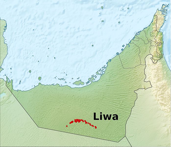
Deutsch: Positionskarte der Vereinigten Arabischen Emirate Quadratische Plattkarte, N-S-Streckung 109 %. Geographische Begrenzung der Karte: * N: 26.5° N * S: 22.4° N * W: 51.4° O * O: 56.6° O English: Location map of the United Arab Emirates Equirectangular projection, N/S stretching 109 %. Geographic limits of the map: * N: 26.5° N * S: 22.4° N * W: 51.4° E * E: 56.6° E |
| 日期 | (UTC) |
| 来源 | |
| 作者 |
|
| 这是一张修改过的图片,这意味着它已在原版本的基础上通过软件进行了编辑,改动内容:location of liwa。其原始版本为:United Arab Emirates relief location map.jpg。修改者:Uwe Dedering。
|
我,本作品著作权人,特此采用以下许可协议发表本作品:
本文件采用知识共享署名-相同方式共享 3.0 未本地化版本许可协议授权。
- 您可以自由地:
- 共享 – 复制、发行并传播本作品
- 修改 – 改编作品
- 惟须遵守下列条件:
- 署名 – 您必须对作品进行署名,提供授权条款的链接,并说明是否对原始内容进行了更改。您可以用任何合理的方式来署名,但不得以任何方式表明许可人认可您或您的使用。
- 相同方式共享 – 如果您再混合、转换或者基于本作品进行创作,您必须以与原先许可协议相同或相兼容的许可协议分发您贡献的作品。
原始上传日志
This image is a derivative work of the following images:
- File:United_Arab_Emirates_relief_location_map.jpg licensed with Cc-by-sa-3.0
- 2010-08-05T09:30:52Z Uwe Dedering 1228x1055 (684481 Bytes) {{Information |Description={{de|Positionskarte der [[:de:Vereinigte Arabische Emirate|Vereinigten Arabischen Emirate]]}} Quadratische Plattkarte, N-S-Streckung 109 %. Geographische Begrenzung der Karte: * N: 26.5° N * S: 22.
Uploaded with derivativeFX
文件历史
点击某个日期/时间查看对应时刻的文件。
| 日期/时间 | 缩略图 | 大小 | 用户 | 备注 | |
|---|---|---|---|---|---|
| 当前 | 2010年8月5日 (四) 10:37 | | 1,228 × 1,055(675 KB) | Uwe Dedering | text bigger for better readability |
| 2010年8月5日 (四) 10:30 |  | 1,228 × 1,055(676 KB) | Uwe Dedering | less banana, more oasis | |
| 2010年8月5日 (四) 09:35 |  | 1,228 × 1,055(672 KB) | Uwe Dedering | {{Information |Description={{de|Positionskarte der Vereinigten Arabischen Emirate}} Quadratische Plattkarte, N-S-Streckung 109 %. Geographische Begrenzung der Karte: * N: 26.5° N * S: 22.4° N * W: 51.4° O * O: 56.6� |
文件用途
以下页面使用本文件:
全域文件用途
以下其他wiki使用此文件:
- cs.wikipedia.org上的用途
- de.wikipedia.org上的用途
- en.wikipedia.org上的用途
- eo.wikipedia.org上的用途
- fa.wikipedia.org上的用途
- fr.wikipedia.org上的用途
- ja.wikipedia.org上的用途
- lt.wikipedia.org上的用途
- nl.wikipedia.org上的用途
- nn.wikipedia.org上的用途
- ta.wikipedia.org上的用途
- th.wikipedia.org上的用途
- tr.wikipedia.org上的用途