File:Lowell National Historical Park Official Map.jpg
本预览的尺寸:722 × 600像素。 其他分辨率:289 × 240像素 | 578 × 480像素 | 925 × 768像素 | 1,233 × 1,024像素 | 2,384 × 1,980像素。
原始文件 (2,384 × 1,980像素,文件大小:917 KB,MIME类型:image/jpeg)
摘要
| 描写 |
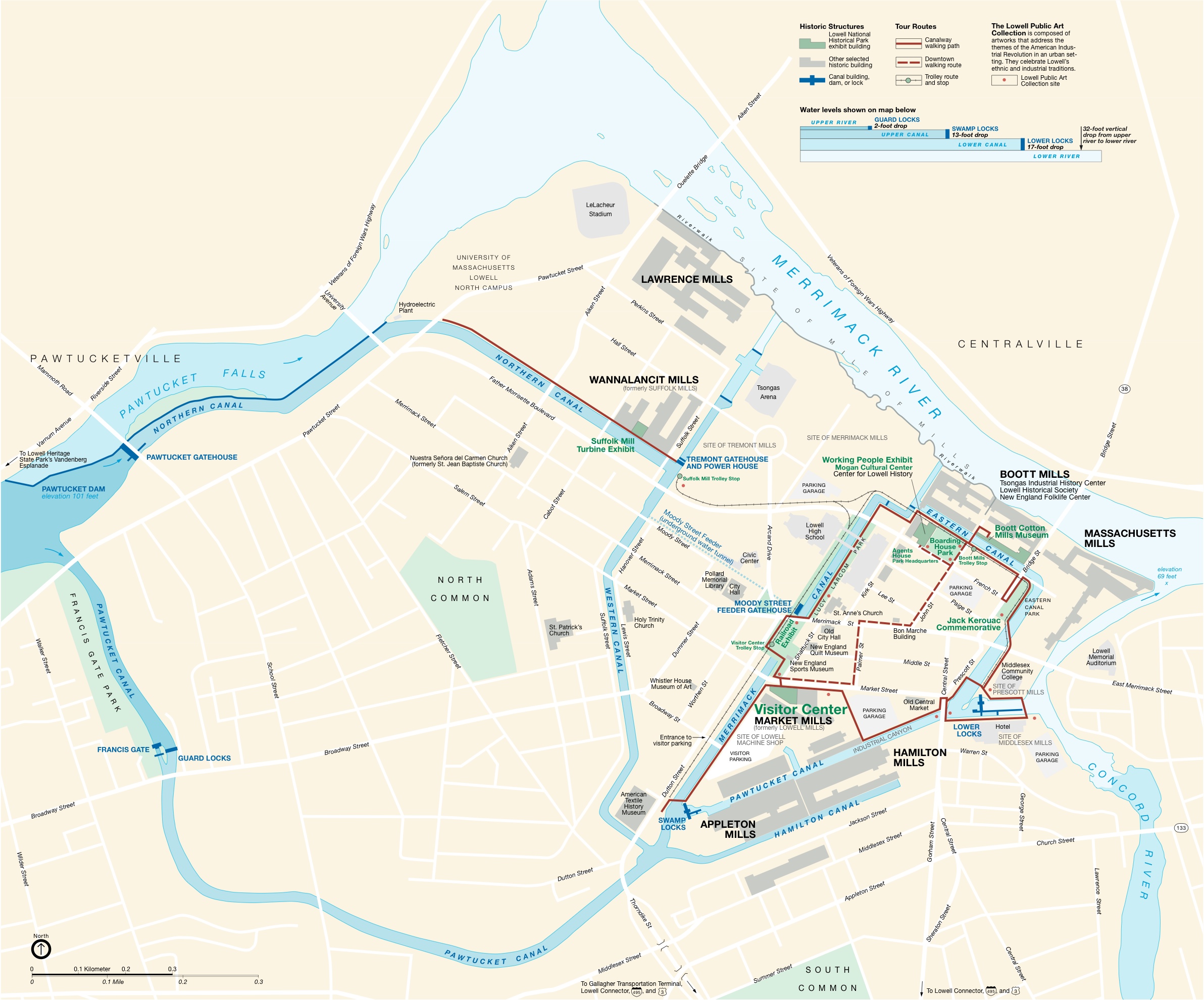
English: National Park Service map of the Lowell National Historical Park — in Lowell, Massachusetts. |
|||||||||
| 来源 | National Park Service | |||||||||
| 创作作者 |
National Park Service |
|||||||||
| Geotemporal data | ||||||||||
| 地图位置 | Lowell, MA | |||||||||
| 地图类型 | thematic | |||||||||
| 比例尺 | 1:6340 | |||||||||
| 标题 |
 |
|||||||||
| 边框 |
|
|||||||||
| 地理参考 | ||||||||||
许可协议
| This image or media file contains material based on a work of a National Park Service employee, created as part of that person's official duties. As a work of the U.S. federal government, such work is in the public domain in the United States. See the NPS website and NPS copyright policy for more information. |
文件历史
点击某个日期/时间查看对应时刻的文件。
| 日期/时间 | 缩略图 | 大小 | 用户 | 备注 | |
|---|---|---|---|---|---|
| 当前 | 2009年7月13日 (一) 14:50 | | 2,384 × 1,980(917 KB) | Jlpapple | {{Information |Description= |Source=NPS |Date= |Author= |Permission= |other_versions= }} Category:Maps |
| 2009年7月13日 (一) 14:50 |  | 2,384 × 1,980(917 KB) | Jlpapple | {{Information |Description= |Source=NPS |Date= |Author= |Permission= |other_versions= }} Category:Maps |
文件用途
以下页面使用本文件:
全域文件用途
以下其他wiki使用此文件:
- en.wikipedia.org上的用途
- fr.wikipedia.org上的用途
- nl.wikipedia.org上的用途