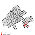
File:Map - NL - 's-Gravenhage - Wijk 42 Ypenburg - Buurt 13 Singels.svg

此SVG文件的PNG预览的大小:375 × 375像素。 其他分辨率:240 × 240像素 | 480 × 480像素 | 768 × 768像素 | 1,024 × 1,024像素 | 2,048 × 2,048像素。
原始文件 (SVG文件,尺寸为375 × 375像素,文件大小:71 KB)
文件历史
点击某个日期/时间查看对应时刻的文件。
| 日期/时间 | 缩略图 | 大小 | 用户 | 备注 | |
|---|---|---|---|---|---|
| 当前 | 2009年4月19日 (日) 19:18 |  | 375 × 375(71 KB) | Michiel1972 | {{Information |Description=<!--correct utf8, ALSO show buurt boundaries outside the "wijk" of the shown "buurt" --> |Source=own work, using free available sources |Date= |Author=Michiel1972, {{Attribution|nolink=[http://www.cbs.nl Centraal Bureau voor de |
| 2009年3月20日 (五) 22:53 |  | 375 × 375(35 KB) | Michiel1972 | {{Information |Description=*{{subst:PAGENAME}} *locator map showing municipality boundary (2009) and statistical district/neighbourhood boundaries according to CBS *Numbering and names of neighboorhoods as defined by CBS in the 2008 Esri publication brt_2 |
文件用途
以下页面使用本文件:
全域文件用途
以下其他wiki使用此文件:
- nl.wikipedia.org上的用途

