File:Mars from Phoenix.jpg
本预览的尺寸:600 × 600像素。 其他分辨率:240 × 240像素 | 480 × 480像素 | 768 × 768像素 | 1,024 × 1,024像素。
原始文件 (1,024 × 1,024像素,文件大小:294 KB,MIME类型:image/jpeg)
| 描述 |
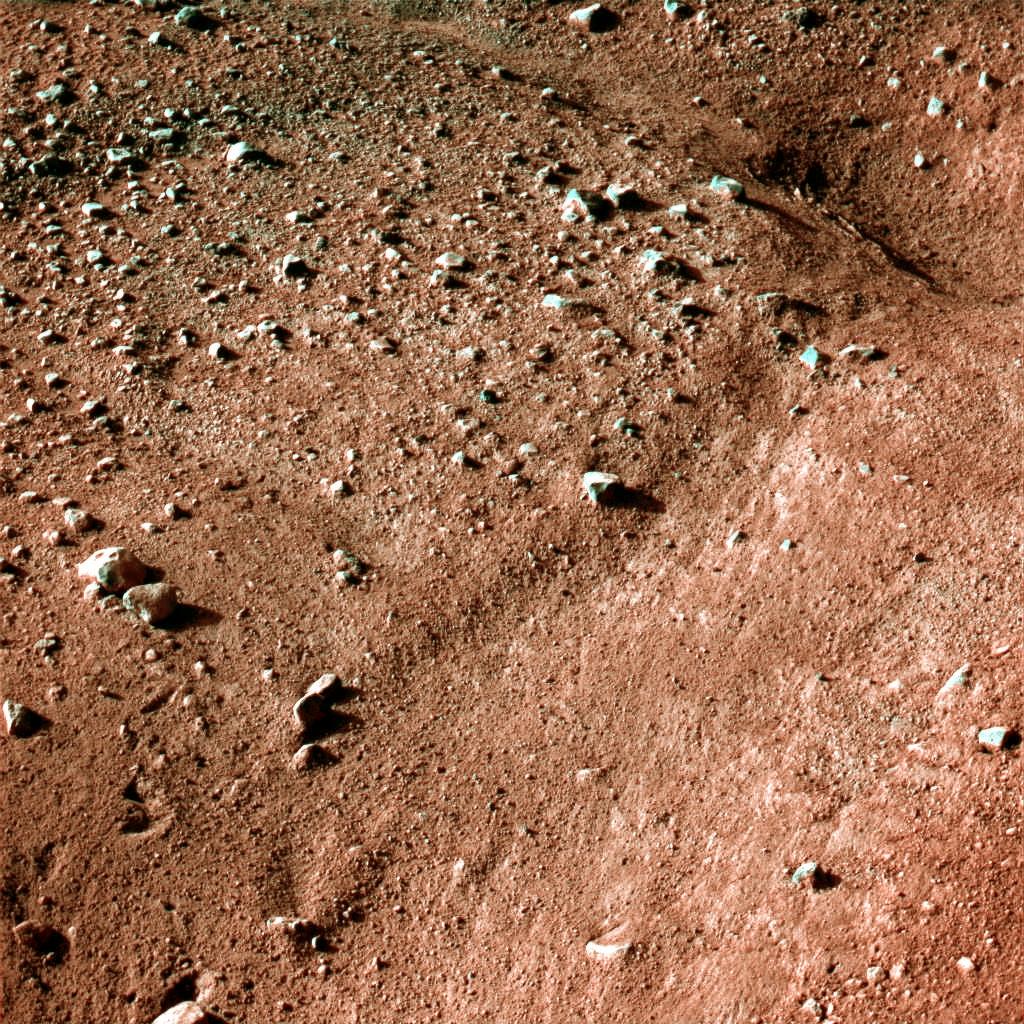
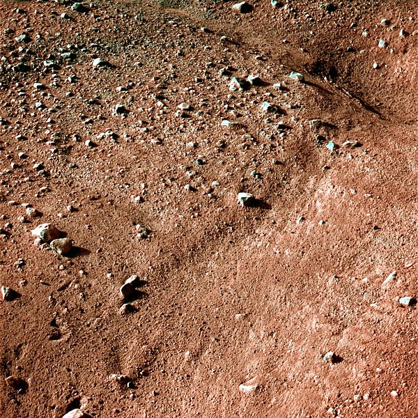
This image shows a polygonal pattern in the ground near NASA's Phoenix Mars Lander, similar in appearance to icy ground in the arctic regions of Earth. Phoenix was confirmed to have touched down on the Red Planet at 22:53 GMT, 25 May, 2008, in an arctic region called Vastitas Borealis, at 68 degrees north latitude, 234 degrees east longitude. This is an approximate-colour image taken shortly after landing by the spacecraft's Surface Stereo Imager, inferred from two colour filters, a violet, 450-nanometre filter and an infrared, 750-nanometre filter. The Phoenix Mission is led by the University of Arizona, Tucson, on behalf of NASA. Project management of the mission is by NASA's Jet Propulsion Laboratory, Pasadena, California. Spacecraft development is by Lockheed Martin Space Systems, Denver. |
|||||
| 日期 | ||||||
| 来源 | http://www.nasa.gov/mission_pages/phoenix/images/press/false_color_postcard_edr.html | |||||
| 作者 | NASA/JPL-Caltech/University of Arizona | |||||
| 授权 (二次使用本文件) |
|

文件历史
点击某个日期/时间查看对应时刻的文件。
| 日期/时间 | 缩略图 | 大小 | 用户 | 备注 | |
|---|---|---|---|---|---|
| 当前 | 2008年5月26日 (一) 07:51 | | 1,024 × 1,024(294 KB) | WDGraham | {{Information |Description=This image shows a polygonal pattern in the ground near NASA's Phoenix Mars Lander, similar in appearance to icy ground in the arctic regions of Earth. Phoenix was confirmed to have touched down on the Red Planet at 22:53 GMT, |
文件用途
以下页面使用本文件:
全域文件用途
以下其他wiki使用此文件:
- be.wikipedia.org上的用途
- bg.wikipedia.org上的用途
- ca.wikipedia.org上的用途
- da.wikipedia.org上的用途
- de.wikipedia.org上的用途
- de.wikinews.org上的用途
- en.wikipedia.org上的用途
- en.wikinews.org上的用途
- eo.wikipedia.org上的用途
- fa.wikipedia.org上的用途
- hu.wikipedia.org上的用途
- hu.wikinews.org上的用途
- hy.wikipedia.org上的用途
- incubator.wikimedia.org上的用途
- it.wikinews.org上的用途
- ja.wikipedia.org上的用途
- kk.wikipedia.org上的用途
- mk.wikipedia.org上的用途
- nds.wikipedia.org上的用途
- nl.wikipedia.org上的用途
- pt.wikipedia.org上的用途
- ru.wikipedia.org上的用途
- ru.wikinews.org上的用途
- sv.wikipedia.org上的用途
- tr.wikipedia.org上的用途
- uk.wikipedia.org上的用途