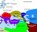
File:Pontic steppe region around 650 AD.png
Pontic_steppe_region_around_650_AD.png (637 × 553像素,文件大小:40 KB,MIME类型:image/png)
文件历史
点击某个日期/时间查看对应时刻的文件。
| 日期/时间 | 缩略图 | 大小 | 用户 | 备注 | |
|---|---|---|---|---|---|
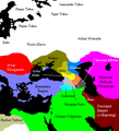
| 当前 | 2022年10月14日 (五) 17:35 |  | 637 × 553(40 KB) | Gyalu22 | The Byzantine and Sassanian empires were under invasion |
| 2016年2月24日 (三) 20:33 |  | 637 × 553(53 KB) | Taron Saharyan | Армения был автономна, см. Theodore Rshtuni | |
| 2015年12月23日 (三) 13:35 |  | 637 × 553(51 KB) | Ercwlff | for 650 armenia was already conquered by the arabs | |
| 2015年9月25日 (五) 11:08 |  | 637 × 553(53 KB) | Taron Saharyan | исправлены восточные пределы Армении | |
| 2014年8月10日 (日) 11:10 |  | 637 × 553(40 KB) | Spiridon Ion Cepleanu | Cosmetic little changes according with H.E.Stier (dir.) « Westermann Grosser Atlas zur Weltgeschichte », 1985, ISBN 3-14-100919-8, the « Putzger historischer Weltatlas Cornelsen » 1990, ISBN 3-464-00176-8, the André & Jean Sellier « Atlas des Peu... | |
| 2007年5月25日 (五) 10:43 |  | 637 × 553(27 KB) | Angusmclellan | {{Information |Description=The en:Pontic steppe region, c. AD 650. en:Category:Historical maps by User:Briangotts en:Category:Maps of the history of Russia |Source=Originally from [http://en.wikipedia.org en.wikipedia]; description page | |
| 2006年1月17日 (二) 08:44 |  | 406 × 448(15 KB) | Jrohr | == Summary == The Pontic steppe region, c. 650 CE. Category:Historical maps by User:Briangotts == Licensing == {{GFDL-self}} |
文件用途
以下页面使用本文件:
全域文件用途
以下其他wiki使用此文件:
- af.wikipedia.org上的用途
- ar.wikipedia.org上的用途
- azb.wikipedia.org上的用途
- az.wikipedia.org上的用途
- ba.wikipedia.org上的用途
- be.wikipedia.org上的用途
- bg.wikipedia.org上的用途
- ca.wikipedia.org上的用途
- cs.wikipedia.org上的用途
- cu.wikipedia.org上的用途
- cv.wikipedia.org上的用途
- da.wikipedia.org上的用途
- de.wikipedia.org上的用途
- de.wikibooks.org上的用途
- de.wikiversity.org上的用途
- el.wikipedia.org上的用途
- en.wikipedia.org上的用途
- eo.wikipedia.org上的用途
- es.wikipedia.org上的用途
- eu.wikipedia.org上的用途
- fa.wikipedia.org上的用途
- fi.wikipedia.org上的用途
查看本文件的更多全域用途。


