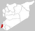
File:Quneitra-map.png
Quneitra-map.png (672 × 594像素,文件大小:10 KB,MIME类型:image/png)
文件历史
点击某个日期/时间查看对应时刻的文件。
| 日期/时间 | 缩略图 | 大小 | 用户 | 备注 | |
|---|---|---|---|---|---|
| 当前 | 2012年3月18日 (日) 11:07 |  | 672 × 594(10 KB) | OgreBot | (BOT): Reverting to most recent version before archival |
| 2012年3月18日 (日) 11:07 |  | 672 × 594(19 KB) | OgreBot | (BOT): Uploading old version of file from en.wikipedia; originally uploaded on 2006-03-29 02:35:45 by LittleDan | |
| 2012年3月18日 (日) 11:07 |  | 672 × 594(20 KB) | OgreBot | (BOT): Uploading old version of file from en.wikipedia; originally uploaded on 2006-03-29 01:49:52 by LittleDan | |
| 2012年3月18日 (日) 11:02 |  | 672 × 594(10 KB) | File Upload Bot (Magnus Manske) | {{BotMoveToCommons|en.wikipedia|year={{subst:CURRENTYEAR}}|month={{subst:CURRENTMONTHNAME}}|day={{subst:CURRENTDAY}}}} {{Information |Description={{en|Based on Syrnumbered.PNG by en:User:Yuber}} |Source=Transferred from [http://en.wikipedia.org ... |
文件用途
以下页面使用本文件:
全域文件用途
以下其他wiki使用此文件:
- ar.wikipedia.org上的用途
- az.wikipedia.org上的用途
- bn.wikipedia.org上的用途
- ckb.wikipedia.org上的用途
- diq.wikipedia.org上的用途
- en.wikipedia.org上的用途
- Quneitra
- Ein Gev
- Buq'ata
- Majdal Shams
- Ghajar
- HaOn
- Quneitra Governorate
- Fiq, Syria
- Fiq District
- Quneitra District
- Mas'ade
- Beer Ajam
- Gadot, Israel
- Ma'agan
- Tel Katzir
- Snir
- Template:Quneitra Governorate
- Syrian towns and villages depopulated in the Arab–Israeli conflict
- Shayta
- Jubata ez-Zeit
- Al-'Al
- User:Supreme Deliciousness/misc
- User:Huldra/Syria
- Bariqa
- Khan Arnabah
- Al-Ahmadiyah
- Katzrin
- Madinat al-Baath
- Ein Qiniyye
- Template:QuneitraSY-geo-stub
- Hader, Quneitra Governorate
- Al-Rafid, Syria
- Jubata al-Khashab
- Khushniyeh
- Jabah
- Elmahjer
- Quneitra Subdistrict
- Jabta Elhashab Subdistrict
- 'Ayn Fit
- Kafr Naffakh
- Za'ura, Syria
- As-Summaqah
- Er-Ramthaniyye
- Mansura, Syria
查看此文件的更多全域用途。


