File:Rhus copallinum range map 3.png

本预览的尺寸:600 × 600像素。 其他分辨率:240 × 240像素 | 480 × 480像素 | 768 × 768像素 | 1,024 × 1,024像素 | 2,048 × 2,048像素 | 4,860 × 4,860像素。
原始文件 (4,860 × 4,860像素,文件大小:363 KB,MIME类型:image/png)
摘要
| 描述 |
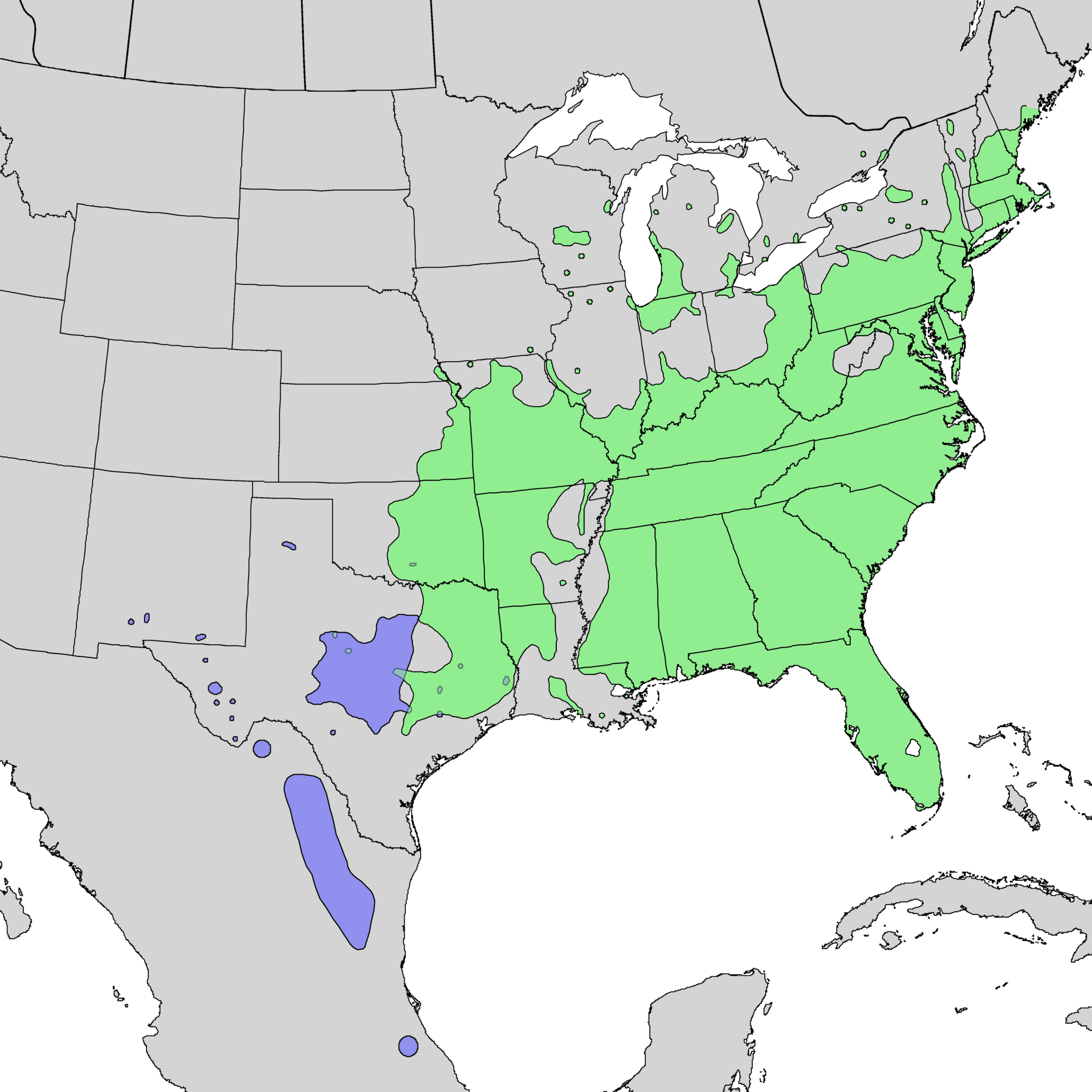
English: Range map of Rhus copallinum var. copallinum (green) and var. lanceolata (blue) |
| 日期 | 1976, 1977 & 1999 |
| 来源 | USGS Geosciences and Environmental Change Science Center: Digital Representations of Tree Species Range Maps from: Elbert L. Little, Jr. (1976), Atlas of United States trees, Vol. 3, minor Western hardwoods: U.S. Department of Agriculture Miscellaneous Publication 1314, 13 p., 290 maps and Elbert L. Little, Jr. (1977), Atlas of United States trees, Vol. 4, minor Eastern hardwoods: U.S. Department of Agriculture Miscellaneous Publication 1342, 17 p., 230 maps. |
| 作者 | Elbert L. Little, Jr., of the U.S. Department of Agriculture, Forest Service / U.S. Geological Survey |
许可协议
|
|
原始上传日志
Transferred from en.wikipedia to Commons by Pinethicket using CommonsHelper.
The original description page was here. All following user names refer to en.wikipedia.
- 2010-05-16 05:11 Masebrock 626×545× (114346 bytes) {{Information |Description=Range map of Rhus copallina |Source=Digital representation of "Atlas of United States Trees" by Elbert L. Little, Jr. [http://esp.cr.usgs.gov/data/atlas/little/] |Date=1999 |Author=U.S. Geological Survey |Permission={{PD-USGov-
文件历史
点击某个日期/时间查看对应时刻的文件。
| 日期/时间 | 缩略图 | 大小 | 用户 | 备注 | |
|---|---|---|---|---|---|
| 当前 | 2013年12月20日 (五) 21:31 | | 4,860 × 4,860(363 KB) | Nonenmac | higher resolution, no striping problem, white water bodies, province borders, both subtaxa, color-coded |
| 2012年10月22日 (一) 20:44 |  | 626 × 545(112 KB) | File Upload Bot (Magnus Manske) | Transfered from en.wikipedia by User:Pinethicket using CommonsHelper |
文件用途
以下页面使用本文件:
全域文件用途
以下其他wiki使用此文件:
- ceb.wikipedia.org上的用途
- en.wikipedia.org上的用途
- es.wikipedia.org上的用途
- sv.wikipedia.org上的用途
- www.wikidata.org上的用途