File:SeychellesBIOT1970.jpg
此为最大尺寸。
SeychellesBIOT1970.jpg (780 × 283像素,文件大小:72 KB,MIME类型:image/jpeg)
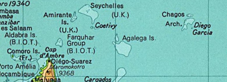
Map of the Seychelles and British Indian Ocean Territory prior to 1976. From the National Atlas as mirrored by the PCL.
本地图取自美国国家地图集的某个版本。正如几乎所有美国联邦政府作品一样,来自国家地图集的作品在美国属于公有领域。
在线访问:NationalAtlas.gov | 1970年印刷版:国会图书馆、Perry-Castañeda图书馆
|
This map was cropped from there.
文件历史
点击某个日期/时间查看对应时刻的文件。
| 日期/时间 | 缩略图 | 大小 | 用户 | 备注 | |
|---|---|---|---|---|---|
| 当前 | 2005年8月13日 (六) 02:01 | 780 × 283(72 KB) | Hoshie | Map of the Seychelles and British Indian Ocean Territory piror to 1976. From the National Atlas as mirrored by the [http://www.lib.utexas.edu/maps/ PCL]. {{PD-USGov-Atlas}} {{PD-PCL|http://www.lib.utexas.edu/maps/national_atlas_1970/ca000244_large.jpg}} |
文件用途
以下页面使用本文件:
全域文件用途
以下其他wiki使用此文件:
- af.wikipedia.org上的用途
- ast.wikipedia.org上的用途
- ca.wikipedia.org上的用途
- el.wikipedia.org上的用途
- en.wikipedia.org上的用途
- eo.wikipedia.org上的用途
- id.wikipedia.org上的用途
- tl.wikipedia.org上的用途