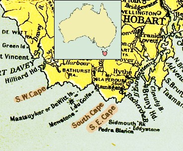
File:Tasmania southern coast 1916.jpg
Tasmania_southern_coast_1916.jpg (369 × 304像素,文件大小:69 KB,MIME类型:image/jpeg)
文件历史
点击某个日期/时间查看对应时刻的文件。
| 日期/时间 | 缩略图 | 大小 | 用户 | 备注 | |
|---|---|---|---|---|---|
| 当前 | 2007年4月17日 (二) 06:46 |  | 369 × 304(69 KB) | Ibn Battuta | okay, okay, okay: I'll leave (make) "Hobart" visible... :o) ... |
| 2007年4月17日 (二) 06:30 |  | 369 × 304(69 KB) | Ibn Battuta | Let's try again: including locator map!? | |
| 2007年4月17日 (二) 06:18 |  | 369 × 304(69 KB) | Ibn Battuta | included locator map of Tasmania | |
| 2007年4月1日 (日) 06:46 |  | 369 × 304(76 KB) | Ibn Battuta | {{Information |Description=Southern Coast of Tasmania. <br/>From the map "Commonwealth of Australia", published with the Official Year Book of the Commonwealth of Australia, Melbourne: McCarron, Bird and Co., 1916. |Source=map "Commonwealth of Australia", |
文件用途
以下页面使用本文件:
全域文件用途
以下其他wiki使用此文件:
- ar.wikipedia.org上的用途
- ceb.wikipedia.org上的用途
- de.wikipedia.org上的用途
- en.wikipedia.org上的用途
- eo.wikipedia.org上的用途
- eu.wikipedia.org上的用途
- id.wikipedia.org上的用途
- it.wikipedia.org上的用途
- pt.wikipedia.org上的用途
- ru.wikipedia.org上的用途
- uk.wikipedia.org上的用途
- www.wikidata.org上的用途


