File:Tinian soil 1988.jpg

本预览的尺寸:235 × 599像素。 其他分辨率:94 × 240像素 | 188 × 480像素 | 301 × 768像素 | 1,108 × 2,822像素。
原始文件 (1,108 × 2,822像素,文件大小:288 KB,MIME类型:image/jpeg)
摘要
| 描述 |
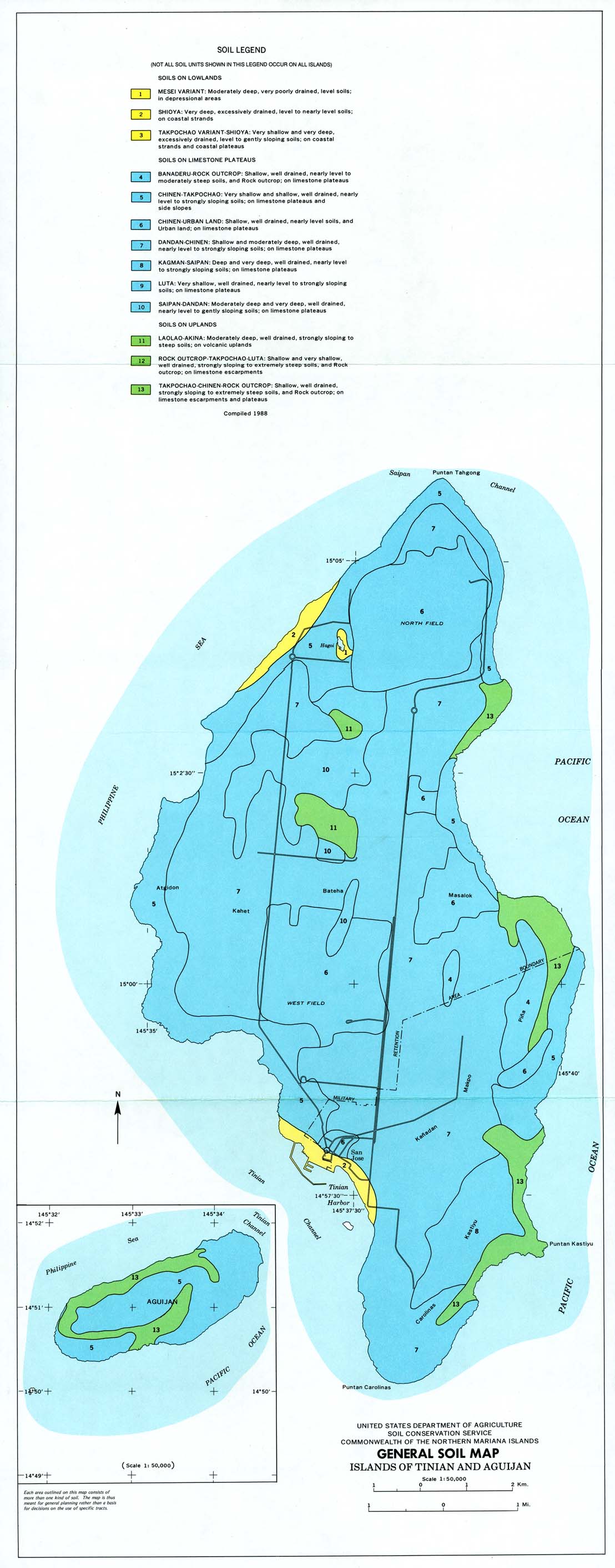
English: Map of soil types on the islands of Tinian and Aguijan in the Commonwealth of the Northern Mariana Islands, as of 1988. |
| 日期 | |
| 来源 | https://maps.lib.utexas.edu/maps/australia/tinian_soil_1988.jpg |
| 作者 | United States Department of Agriculture, Soil Conservation Service |
许可协议
此作品在美国属于公有领域,因为其是由美国政府的官员或雇员,基于其个人公务目的制作的作品,参考美国法典第17篇第1章第105条。
注意︰本模板仅适用于美国联邦政府的原创作品,不适用于任何美国州、属地、联邦个体、县、市或任何次级政府的作品。本模板也不适用于1978年以后由美国邮政署出版的邮票图案(参看美国版权局实践纲领第313.6(C)(1)条)。也不适用于部分美国硬币;参看美国铸币局使用条款。 |
 | |
| 本文件已被确认为免除已知的著作权法限制(包括所有相关权利)。 | ||
文件历史
点击某个日期/时间查看对应时刻的文件。
| 日期/时间 | 缩略图 | 大小 | 用户 | 备注 | |
|---|---|---|---|---|---|
| 当前 | 2021年8月21日 (六) 00:45 | 1,108 × 2,822(288 KB) | Beland | Uploaded a work by United States Department of Agriculture, Soil Conservation Service from https://maps.lib.utexas.edu/maps/australia/tinian_soil_1988.jpg with UploadWizard |
文件用途
以下页面使用本文件: