File:Bessarabia.png

本预览的尺寸:537 × 599像素。 其他分辨率:215 × 240像素 | 544 × 607像素。
原始文件 (544 × 607像素,文件大小:49 KB,MIME类型:image/png)
摘要
| 描述 |
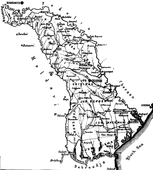
English: The map of the region of Bessarabia (1812-1917) Română: Harta Basarabiei Русский: Карта Бессарабии |
| 日期 | |
| 来源 | http://depts.washington.edu/cartah/text_archive/clark/b_22.jpg |
| 作者 | Celeron |
许可协议
|
本作品在其来源国以及其他著作权期限是作者逝世后70年或以下的国家和地区属于公有领域。 | |
| 本文件已被确认为免除已知的著作权法限制(包括所有相关权利)。 | |
Comment 1
better version of map at 
Comment 2
This map is from the book "Bessarabia, Russia, and Roumania on the Black Sea" by Charles Upson Clark.
An electronic version of the book is available online: http://depts.washington.edu/cartah/text_archive/clark/meta_pag.shtml
文件历史
点击某个日期/时间查看对应时刻的文件。
| 日期/时间 | 缩略图 | 大小 | 用户 | 备注 | |
|---|---|---|---|---|---|
| 当前 | 2006年5月19日 (五) 20:52 | | 544 × 607(49 KB) | Zserghei | This image was copied from wikipedia:en. The original description was: {{PD}} ==Comment 1== better version of map at Image:Bessarabia.jpg ==Comment 2== This map is from the book "Bessarabia, Russia, and Roumania on the Black Sea" by Charles Upson C |
| 2005年10月3日 (一) 00:47 |  | 544 × 607(49 KB) | Celeron | {{pd}} bessarabia's map |
文件用途
以下页面使用本文件:
全域文件用途
以下其他wiki使用此文件:
- ar.wikipedia.org上的用途
- ast.wikipedia.org上的用途
- beta.wikiversity.org上的用途
- ca.wikipedia.org上的用途
- cs.wikipedia.org上的用途
- dsb.wikipedia.org上的用途
- en.wikipedia.org上的用途
- es.wikipedia.org上的用途
- eu.wikipedia.org上的用途
- id.wikipedia.org上的用途
- is.wikipedia.org上的用途
- it.wikipedia.org上的用途
- ko.wikipedia.org上的用途
- mk.wikipedia.org上的用途
- ms.wikipedia.org上的用途
- nl.wikipedia.org上的用途
- no.wikipedia.org上的用途
- pl.wikipedia.org上的用途
- pnb.wikipedia.org上的用途
- ro.wikipedia.org上的用途
- sl.wikipedia.org上的用途
- sq.wikipedia.org上的用途
- sv.wikipedia.org上的用途
- tr.wikipedia.org上的用途
- uk.wikipedia.org上的用途
- ur.wikipedia.org上的用途
- vi.wikipedia.org上的用途