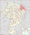
File:Sextner Dolomiten.png

本预览的尺寸:516 × 599像素。 其他分辨率:207 × 240像素 | 413 × 480像素 | 661 × 768像素 | 882 × 1,024像素 | 1,764 × 2,048像素 | 4,311 × 5,006像素。
原始文件 (4,311 × 5,006像素,文件大小:5.5 MB,MIME类型:image/png)
文件历史
点击某个日期/时间查看对应时刻的文件。
| 日期/时间 | 缩略图 | 大小 | 用户 | 备注 | |
|---|---|---|---|---|---|
| 当前 | 2018年3月18日 (日) 16:52 |  | 4,311 × 5,006(5.5 MB) | Pechristener | == {{int:filedesc}} == {{Map |Description={{de|1=Karte der Dolomiten mit {{w|Sextner Dolomiten||de}}}} |Source ={{own}} Map was created using: *[http://www.openstreetmap.org/ Open Street Map] *Italy_North_location_map.svg for location map |Author = *Artwork: Pechristener *Location map: File:Italy_North_location_map.svg: NordNordWest |Date =2016-03-18 |Permission =Map data (c) OpenStreetMap (and) contributors, CC-BY-SA |other_versions = }} == {{int:license-header}} == {{self|cc-by-3.0}} {{ODbL}} Category:Topographic maps of Italy Category:Maps of the Dolomites Category:Files by User:FkMohr/Karte Category:Files by User:Pechristener/Karten/Alpen Category:Sexten Dolomites |
文件用途
以下页面使用本文件:
全域文件用途
以下其他wiki使用此文件:
- cs.wikipedia.org上的用途
- de.wikipedia.org上的用途
- es.wikipedia.org上的用途
- fr.wikipedia.org上的用途
- it.wikivoyage.org上的用途

