File:Carte aerienne du robert ShockymapServer.jpg
没有更高的分辨率。
Carte_aerienne_du_robert_ShockymapServer.jpg (587 × 587像素,文件大小:83 KB,MIME类型:image/jpeg)
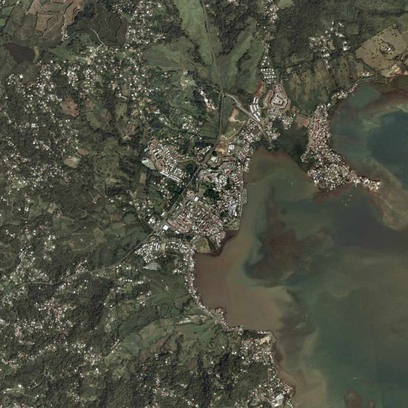
摘要
| 描述 |
Français : la commune du Le Robert (97231) en Martinique (France). |
| 来源 | page jaune |
| 作者 | satellite |
许可协议
Hi, this image isn't property of Nasa but IGN (Institut National Géographique et Forestière). This image has been acquired by airplaine and this image was captured from www.pagesjaunes.fr through InterAtlas Shockymap Application, please contact IGN to have the permission to use it.
Regards.
| 本文件完全由NASA创作,在美国属于公有领域。根据NASA的版权方针,NASA的材料除非另有声明否则不受版权保护。(参见Template:PD-USGov/zh、NASA版权方针页面或JPL图片使用方针。) | ||
 |
警告:
|
文件历史
点击某个日期/时间查看对应时刻的文件。
| 日期/时间 | 缩略图 | 大小 | 用户 | 备注 | |
|---|---|---|---|---|---|
| 当前 | 2009年3月9日 (一) 11:14 | | 587 × 587(83 KB) | Lavermeil | {{Information |Description={{fr|1=la commune du robert 97231}} |Source=page jaune |Author=satellite |Date= |Permission= |other_versions= }} <!--{{ImageUpload|full}}--> |
文件用途
以下页面使用本文件:
全域文件用途
以下其他wiki使用此文件:
- azb.wikipedia.org上的用途
- ca.wikipedia.org上的用途
- ceb.wikipedia.org上的用途
- ce.wikipedia.org上的用途
- el.wikipedia.org上的用途
- en.wikipedia.org上的用途
- es.wikipedia.org上的用途
- eu.wikipedia.org上的用途
- fr.wikipedia.org上的用途
- fr.wikivoyage.org上的用途
- he.wikipedia.org上的用途
- it.wikipedia.org上的用途
- mzn.wikipedia.org上的用途
- nl.wikipedia.org上的用途
- no.wikipedia.org上的用途
- oc.wikipedia.org上的用途
- pl.wikipedia.org上的用途
- pt.wikipedia.org上的用途
- sh.wikipedia.org上的用途
- simple.wikipedia.org上的用途
- sk.wikipedia.org上的用途
- sr.wikipedia.org上的用途
- sv.wikipedia.org上的用途
- sw.wikipedia.org上的用途
- uk.wikipedia.org上的用途
- www.wikidata.org上的用途