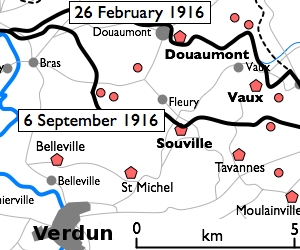
File:Fort Douaumont location map 300px.jpg
Fort_Douaumont_location_map_300px.jpg (300 × 250像素,文件大小:53 KB,MIME类型:image/jpeg)
文件历史
点击某个日期/时间查看对应时刻的文件。
| 日期/时间 | 缩略图 | 大小 | 用户 | 备注 | |
|---|---|---|---|---|---|
| 当前 | 2010年1月10日 (日) 16:27 |  | 300 × 250(53 KB) | Rcbutcher | {{Information |Description=Basic 300-pixel thumbnail map showing location of Fort Doumont in relation to Verdun and the other forts north and northeast of Verdun. The lines of advance of German forces as at 26 February and 6 Septemb |
文件用途
以下页面使用本文件:
全域文件用途
以下其他wiki使用此文件:
- ca.wikipedia.org上的用途
- en.wikipedia.org上的用途
- he.wikipedia.org上的用途
- tr.wikipedia.org上的用途


