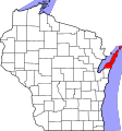
File:Map of Wisconsin highlighting Door County.svg

此SVG文件的PNG预览的大小:560 × 600像素。 其他分辨率:224 × 240像素 | 448 × 480像素 | 717 × 768像素 | 956 × 1,024像素 | 1,912 × 2,048像素 | 1,055 × 1,130像素。
原始文件 (SVG文件,尺寸为1,055 × 1,130像素,文件大小:70 KB)
文件历史
点击某个日期/时间查看对应时刻的文件。
| 日期/时间 | 缩略图 | 大小 | 用户 | 备注 | |
|---|---|---|---|---|---|
| 当前 | 2024年6月25日 (二) 10:47 |  | 1,055 × 1,130(70 KB) | Nux | fix rendering (remove clipping) |
| 2006年2月13日 (一) 00:22 |  | 4,747 × 5,087(103 KB) | David Benbennick | {{subst:User:Dbenbenn/clm|county=Door County|state=Wisconsin|type=county}} | |
| 2006年2月12日 (日) 18:14 |  | 4,747 × 5,087(103 KB) | David Benbennick | {{subst:User:Dbenbenn/clm|county=Door County|state=Wisconsin|type=county}} |
文件用途
以下2个页面使用本文件:
全域文件用途
以下其他wiki使用此文件:
- ar.wikipedia.org上的用途
- bg.wikipedia.org上的用途
- bpy.wikipedia.org上的用途
- cdo.wikipedia.org上的用途
- ceb.wikipedia.org上的用途
- ce.wikipedia.org上的用途
- cy.wikipedia.org上的用途
- de.wikipedia.org上的用途
- en.wikipedia.org上的用途
- List of counties in Wisconsin
- Door County, Wisconsin
- Sturgeon Bay
- Mink River
- Northport, Door County, Wisconsin
- Namur, Wisconsin
- Cana Island
- Pilot Island
- Horseshoe Island (Wisconsin)
- National Register of Historic Places listings in Door County, Wisconsin
- Maplewood, Wisconsin
- Carlsville, Wisconsin
- Institute, Wisconsin
- West Jacksonport, Wisconsin
- Valmy, Wisconsin
- Rowleys Bay, Wisconsin
- Little Sturgeon, Wisconsin
- Detroit Harbor, Wisconsin
- North Bay, Door County, Wisconsin
- Vignes, Wisconsin
- Kolberg, Wisconsin
- Carnot, Wisconsin
- Salona, Wisconsin
- Baileys Harbor (CDP), Wisconsin
- Brussels (community), Wisconsin
- Juddville, Wisconsin
- Peninsula Center, Wisconsin
- Idlewild, Wisconsin
- Washington (community), Wisconsin
- Shoemaker Point, Wisconsin
- User:Rfc1394/sandbox2
- The Ridges Sanctuary
- Coffee Swamp
- Template:DoorCountyWI-geo-stub
- File talk:Map of Wisconsin highlighting Door County.svg
- Fish Island (Wisconsin)
- Hat Island (Wisconsin)
- Gravel Island (Wisconsin)
查看此文件的更多全域用途。
