File:NYCS map 3.svg

此SVG文件的PNG预览的大小:490 × 599像素。 其他分辨率:196 × 240像素 | 393 × 480像素 | 628 × 768像素 | 838 × 1,024像素 | 1,676 × 2,048像素 | 648 × 792像素。
原始文件 (SVG文件,尺寸为648 × 792像素,文件大小:417 KB)
文件历史
点击某个日期/时间查看对应时刻的文件。
| 日期/时间 | 缩略图 | 大小 | 用户 | 备注 | |
|---|---|---|---|---|---|
| 当前 | 2018年6月23日 (六) 16:28 | | 648 × 792(417 KB) | LRG5784 | Reverted to version as of 22:44, 20 March 2016 (UTC) End of weekend changes |
| 2017年6月26日 (一) 19:03 |  | 648 × 792(442 KB) | PrecipiceofDuck | Updated with Hurricane Sandy Fix&Fortify Clark St Tunnel repair work | |
| 2016年3月20日 (日) 22:44 |  | 648 × 792(417 KB) | PrecipiceofDuck | Map updated to show Times Square as late night terminal. | |
| 2016年3月18日 (五) 21:50 |  | 648 × 792(415 KB) | PrecipiceofDuck | Map updated to include 7 line extension. | |
| 2011年11月4日 (五) 21:50 |  | 648 × 792(343 KB) | Train2104 | Text to path | |
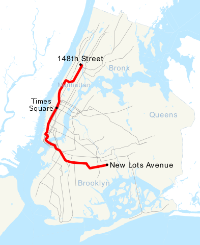
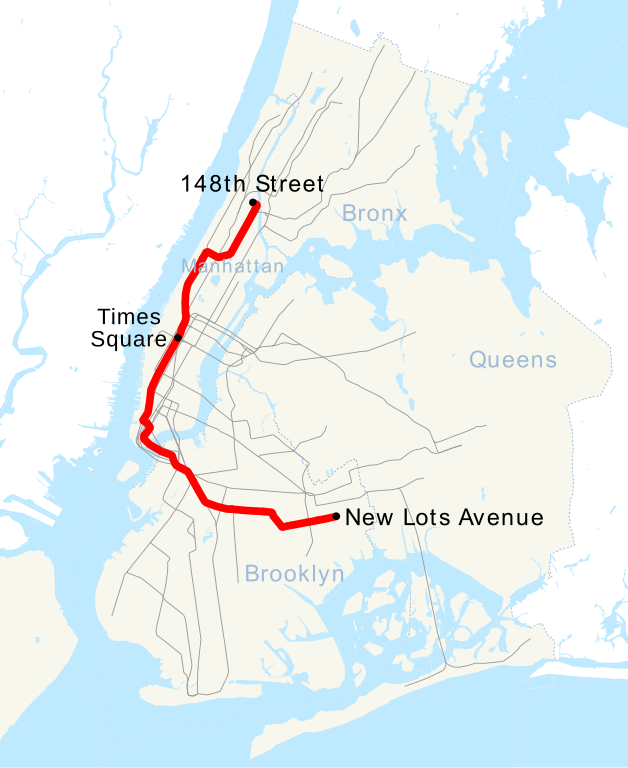
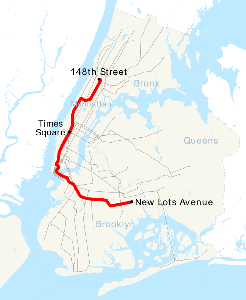
| 2007年4月30日 (一) 23:54 |  | 648 × 792(391 KB) | NE2 | == Summary == This is a map showing the New York City Subway's 3 service. It was created with TIGER/Line GIS data (water and boundaries) and my own data (subway lines and stations, traced on TIGER/Line road data). If you would like a copy of the subway da |
文件用途
以下页面使用本文件:
全域文件用途
以下其他wiki使用此文件:
- ca.wikipedia.org上的用途
- de.wikipedia.org上的用途
- en.wikipedia.org上的用途
- es.wikipedia.org上的用途
- fi.wikipedia.org上的用途
- fr.wikipedia.org上的用途
- he.wikipedia.org上的用途
- ja.wikipedia.org上的用途
- ko.wikipedia.org上的用途
- lmo.wikipedia.org上的用途
- nl.wikipedia.org上的用途
- no.wikipedia.org上的用途
- pl.wikipedia.org上的用途
- pt.wikipedia.org上的用途
- ru.wikipedia.org上的用途
- www.wikidata.org上的用途