File:Approximate extension of the Zagwe Empire.JPG
預覽大小:692 × 600 像素。 其他解析度:277 × 240 像素 | 554 × 480 像素 | 886 × 768 像素 | 1,182 × 1,024 像素 | 1,500 × 1,300 像素。
原始檔案 (1,500 × 1,300 像素,檔案大小:1.87 MB,MIME 類型:image/jpeg)
摘要
| 描述 |
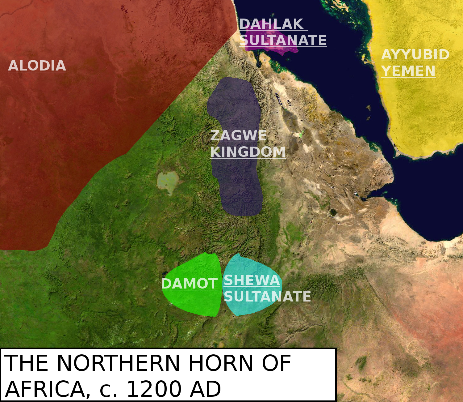
English: Map showing the northern Horn around the year 1200. Original map is called File:Africa_satellite_plane.jpg. Sources used: Encyclopedia Aethiopia Volume 2 and 5, Mohi Zarroug's "Kingdom of Alwa" and Ayda Bouanga's "Le Damot dans l'histoire de l'Ethiopie (XIIIe-XXe siecles)". |
| 日期 | |
| 來源 | 自己的作品 |
| 作者 | LeGabrie |
授權條款
我,本作品的著作權持有者,決定用以下授權條款發佈本作品:
此檔案採用創用CC 姓名標示-相同方式分享 4.0 國際授權條款。
- 您可以自由:
- 分享 – 複製、發佈和傳播本作品
- 重新修改 – 創作演繹作品
- 惟需遵照下列條件:
- 姓名標示 – 您必須指名出正確的製作者,和提供授權條款的連結,以及表示是否有對內容上做出變更。您可以用任何合理的方式來行動,但不得以任何方式表明授權條款是對您許可或是由您所使用。
- 相同方式分享 – 如果您利用本素材進行再混合、轉換或創作,您必須基於如同原先的相同或兼容的條款,來分布您的貢獻成品。
檔案歷史
點選日期/時間以檢視該時間的檔案版本。
| 日期/時間 | 縮圖 | 尺寸 | 使用者 | 備註 | |
|---|---|---|---|---|---|
| 目前 | 2018年3月22日 (四) 15:36 | | 1,500 × 1,300(1.87 MB) | LeGabrie | Made the names transparent |
| 2018年3月17日 (六) 21:41 |  | 1,500 × 1,300(1.88 MB) | LeGabrie | Separated Damot and Shewa, as Damot probably didn't interfer in Shewa until the 1230's. | |
| 2018年3月17日 (六) 17:44 |  | 1,500 × 1,300(1.88 MB) | LeGabrie | Re-added the Shewa Sultanate as part of Damot | |
| 2018年3月17日 (六) 15:41 |  | 1,500 × 1,300(1.87 MB) | LeGabrie | Gave the other kingdoms borders | |
| 2018年3月16日 (五) 21:13 |  | 1,500 × 1,300(2.01 MB) | LeGabrie | Desperately needed historical and aesthetical update | |
| 2015年5月29日 (五) 22:08 |  | 553 × 511(41 KB) | LeGabrie | Deleted one remaining line of the Red Sea. | |
| 2015年5月27日 (三) 21:54 |  | 553 × 511(42 KB) | LeGabrie | User created page with UploadWizard |
檔案用途
下列3個頁面有用到此檔案:
全域檔案使用狀況
以下其他 wiki 使用了這個檔案:
- af.wikipedia.org 的使用狀況
- ar.wikipedia.org 的使用狀況
- cs.wikipedia.org 的使用狀況
- da.wikipedia.org 的使用狀況
- en.wikipedia.org 的使用狀況
- eo.wikipedia.org 的使用狀況
- es.wikipedia.org 的使用狀況
- fr.wikipedia.org 的使用狀況
- id.wikipedia.org 的使用狀況
- it.wikipedia.org 的使用狀況
- ja.wikipedia.org 的使用狀況
- ko.wikipedia.org 的使用狀況
- pt.wikipedia.org 的使用狀況
- uk.wikipedia.org 的使用狀況
- vi.wikipedia.org 的使用狀況