原始檔案 (777 × 838 像素,檔案大小:37 KB,MIME 類型:image/png


摘要

描述
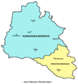
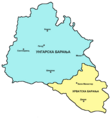
English: Map of Baranya / Baranja region in Hungary and Croatia. Note: it is generally accepted that southern and eastern borders of Baranya / Baranja are rivers Drava and Danube, while north-western borders are less clear. This map show north-western borders of the region in accordance with borders of historical Baranya county in the Kingdom of Hungary, but according to other interpretations, north-western border of Baranya / Baranja is either Mecsek mountain either Balaton lake.
Српски / srpski: Mapa Baranje / zemljovid Baranje u Mađarskoj i Hrvatskoj. Napomena: opšte / opće je prihvaćeno da južnu i istočnu granicu Baranje čine reke / rijeke Drava i Dunav, dok su severozapadne / sjeverozapadne granice manje jasne. Ova mapa / ovaj zemljovid prikazuje severozapadne / sjeverozapadne granice regiona / regije u saglasnosti sa granicama istorijske / povijesne Baranjske županije u Kraljevini Ugarskoj, ali prema drugim interpretacijama, severozapadnu / sjeverozapadnu granicu Baranje čine ili planina Meček ili jezero Balaton.
日期 2006年5月24日 (原始上傳日期)
來源 Transferred from en.wikipedia to Commons.
作者 Original uploader and author was PANONIAN at English wikipedia.
其他版本

授權條款

Self made map by user:PANONIAN.


Public domain 此作品已由其作者,英文維基百科PANONIAN,釋出至公有領域。此授權條款在全世界均適用。
這可能在某些國家不合法,如果是的話:
PANONIAN授予任何人有權利使用此作品於任何用途,除受法律約束外,不受任何限制。

References

  • Školski istorijski atlas, treće izdanje, Zavod za izdavanje udžbenika Socijalističke Republike Srbije, Beograd, 1970.
  • Peter Rokai - Zoltan Đere - Tibor Pal - Aleksandar Kasaš, Istorija Mađara, Beograd, 2002.
  • Nada Miletić Stanić, Pravoslavne crkve u Baranji, Novi Sad, 1999.
  • Stevan Mihaldžić, Baranja od najstarijih vremena do danas, Beograd, 1991.
  • http://upload.wikimedia.org/wikipedia/commons/9/99/Baranya_county_map_(1891).jpg

原始上傳日誌

The original description page was here. All following user names refer to en.wikipedia.
  • 2006-05-24 00:16 PANONIAN 732×779×8 (32939 bytes)

說明

添加單行說明來描述出檔案所代表的內容

在此檔案描寫的項目

描繪內容

61d53c3104fae465b1378413e43a8bdc9ac6b57f

斷定方法:​SHA-1 中文 (已轉換拼寫)

37,386 位元組

838 像素

777 像素

檔案歷史

點選日期/時間以檢視該時間的檔案版本。

日期/時間縮⁠圖尺寸使用者備⁠註
目前2009年10月15日 (四) 10:09於 2009年10月15日 (四) 10:09 版本的縮圖777 × 838(37 KB)WikiEditor2004
2007年3月16日 (五) 22:42於 2007年3月16日 (五) 22:42 版本的縮圖732 × 779(32 KB)Frokor{{Information |Description=Map of Baranya/en:Baranja region (self made) |Source=Originally from [http://en.wikipedia.org en.wikipedia]; description page is/was [http://en.wikipedia.org/w/index.php?title=Image%3ABARANYA.png he

下列頁面有用到此檔案:

全域檔案使用狀況

以下其他 wiki 使用了這個檔案: