File:Blank map of the world (Robinson projection) (10E).svg

此 SVG 檔案的 PNG 預覽的大小:800 × 413 像素。 其他解析度:320 × 165 像素 | 640 × 330 像素 | 1,024 × 529 像素 | 1,280 × 661 像素 | 2,560 × 1,321 像素 | 3,100 × 1,600 像素。
原始檔案 (SVG 檔案,表面大小:3,100 × 1,600 像素,檔案大小:1.33 MB)
_(10E).svg?uselang=zh-hant)
_(10E).svg?uselang=zh-hant)
_(10E).svg?action=history&uselang=zh-hant)
_(10E).svg)

|
這個檔案已經被BlankMap-World.svg取代。 建議您使用其他圖像。請注意要刪除被取代的圖像的話,您需要首先取得社群共識。 使用其他檔案的理由:「Due to a lot of finer detail being regularly updated, it is recommended to use the original file. If a colored version is indeed needed, please take your time update this file from the latest version of the original – it is a fairly trivial exercise that can be done in a couple minutes using a text editor.」
|
摘要
| 描述 |
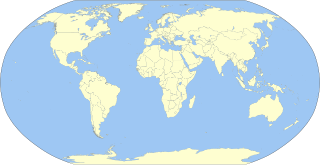
English: A detailed Robinson-projection SVG blank political map with grouping enabled to connect all non-contiguous parts of a country's territory for easy colouring. Smaller countries can also be represented by larger circles to show their data easier. A thorough description of use and other instructions relating to can be found on the instruction page. |
||
| 日期 | |||
| 來源 | 我個人以下列物件為基礎來創作: BlankMap-World.svg 由 Canuckguy | ||
| 作者 | Milenioscuro | ||
| 其他版本 | 此檔案衍生的作品: Corrientes-oceanicas.svg | ||
| SVG開發 |
|
授權條款
我,本作品的著作權持有者,決定用以下授權條款發佈本作品:
| 我,此作品的版權所有人,釋出此作品至公共領域。此授權條款在全世界均適用。 這可能在某些國家不合法,如果是的話: 我授予任何人有權利使用此作品於任何用途,除受法律約束外,不受任何限制。 |
原始上傳日誌
This image is a derivative work of the following images:
- BlankMap-World.svg licensed with PD-self
Uploaded with derivativeFX
檔案歷史
點選日期/時間以檢視該時間的檔案版本。
| 日期/時間 | 縮圖 | 尺寸 | 使用者 | 備註 | |
|---|---|---|---|---|---|
| 目前 | 2023年10月2日 (一) 23:10 | | 3,100 × 1,600(1.33 MB) | Milenioscuro | Reverted to version as of 03:06, 7 March 2015 (UTC) |
| 2023年10月1日 (日) 08:47 |  | 3,100 × 1,600(1.35 MB) | Caawiyahaderon | https://www.thehindu.com/news/international/pro-somalia-militia-takes-key-army-base-in-breakaway-region/article67238670.ece | |
| 2015年3月7日 (六) 03:06 |  | 3,100 × 1,600(1.33 MB) | Milenioscuro | new color scheme | |
| 2014年11月29日 (六) 19:08 |  | 3,100 × 1,600(2 MB) | David1010 | new | |
| 2012年10月9日 (二) 15:16 |  | 3,100 × 1,600(1.99 MB) | Milenioscuro | + Puerto Rico | |
| 2011年5月16日 (一) 04:18 |  | 3,100 × 1,600(1.99 MB) | Milenioscuro | {{Information |Description={{en|1=A detailed Robinson-projection SVG map with grouping enabled to connect all non-contiguous parts of a country's territory for easy colouring. Smaller countries can also be represented by larger circles to sho |
檔案用途
下列頁面有用到此檔案:
全域檔案使用狀況
以下其他 wiki 使用了這個檔案:
- ast.wikipedia.org 的使用狀況
- az.wikipedia.org 的使用狀況
- ba.wikipedia.org 的使用狀況
- be.wikipedia.org 的使用狀況
- bg.wikipedia.org 的使用狀況
- ca.wikipedia.org 的使用狀況
- cs.wikipedia.org 的使用狀況
- dag.wikipedia.org 的使用狀況
- da.wikipedia.org 的使用狀況
- en.wikipedia.org 的使用狀況
- User:Acad Ronin
- User:Tcr25
- User:Bduke
- Wikipedia:Userboxes/Interests
- User:Arkiedragon
- User:Xgravity23
- User:Adamw1993
- User:Svaksha
- User:Goldsztajn
- User:Dcmacnut
- Wikipedia:Userboxes/Travel
- User:Paperworkorange
- User:Anas1712
- User:Alfie66
- Talk:Dependent territory/Archive 1
- User:Stefán Örvar Sigmundsson
- User:Arkenstrone
- User:The Emperor of Byzantium
- User:Arkiedragon/userboxes
- User:Muzilon
- User:Byrappa
- User:EdJF
- User:RubenSchade/Userboxes
- User:Duke of Geography
- User:Drdpw
- User:Rtucker913/userboxes
- User:Greatuser/userboxes
- User:Greatuser/Userboxes/countries visited
- User:Greatuser/Userboxes/countries visited/doc
- User:Guillermofdezg
- User:Liberty Pedia
- User:Gray Catbird
- Wikipedia:Userboxes/Interests/05
- User:Farmboybello
檢視此檔案的更多全域使用狀況。
_(10E).svg)
_(10E).svg)