File:Jammu and Kashmir in 1946 map of India by National Geographic.jpg

預覽大小:769 × 599 像素。 其他解析度:308 × 240 像素 | 616 × 480 像素 | 985 × 768 像素 | 1,280 × 998 像素 | 1,551 × 1,209 像素。
原始檔案 (1,551 × 1,209 像素,檔案大小:429 KB,MIME 類型:image/jpeg)
摘要
| 描述 |
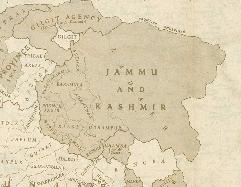
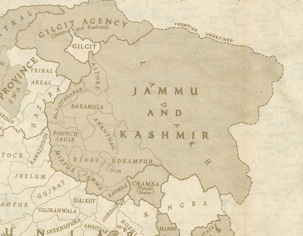
English: This is one of the last few maps of Jammu and Kashmir produced during the British Raj, just before the independence of India and Pakistan |
| 日期 | |
| 來源 | http://pahar.in/wpfb-file/1946-political-subdivisions-of-india-by-national-geographic-jpg/ |
| 作者 | National Geographic |
| 其他版本 |

授權條款
This media file is in the public domain in the United States. This applies to U.S. works where the copyright has expired, often because its first publication occurred prior to January 1, {{{year}}}, and if not then due to lack of notice or renewal. See this page for further explanation.
|
 | |
 |
檔案歷史
點選日期/時間以檢視該時間的檔案版本。
| 日期/時間 | 縮圖 | 尺寸 | 使用者 | 備註 | |
|---|---|---|---|---|---|
| 目前 | 2020年10月21日 (三) 20:48 | | 1,551 × 1,209(429 KB) | Kautilya3 | Uploaded a work by National Geographic from http://pahar.in/wpfb-file/1946-political-subdivisions-of-india-by-national-geographic-jpg/ with UploadWizard |
檔案用途
下列頁面有用到此檔案:
全域檔案使用狀況
以下其他 wiki 使用了這個檔案:
- bn.wikipedia.org 的使用狀況
- en.wikipedia.org 的使用狀況
- Azad Kashmir
- Gilgit Agency
- History of Poonch District
- Talk:Sino-Indian border dispute
- Gilgit-Baltistan
- Elections in Jammu and Kashmir
- Ardagh–Johnson Line
- 1947 Jammu massacres
- Template:User J&K princely state
- Wikipedia:Userboxes/Location/Kashmir
- Forward policy (Sino-Indian conflict)
- 1837 Poonch Revolt
- 1947 Gilgit rebellion
- User:Falcaorib/India and Pakistan
- en.wikivoyage.org 的使用狀況
- hi.wikipedia.org 的使用狀況
- ko.wikipedia.org 的使用狀況
- nl.wikipedia.org 的使用狀況
- sd.wikipedia.org 的使用狀況
- te.wikipedia.org 的使用狀況