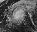
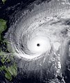
File:Mitag 2002-03-05 1400Z.jpg

預覽大小:506 × 599 像素。 其他解析度:203 × 240 像素 | 405 × 480 像素 | 648 × 768 像素 | 864 × 1,024 像素 | 1,729 × 2,048 像素 | 3,492 × 4,137 像素。
原始檔案 (3,492 × 4,137 像素,檔案大小:4.97 MB,MIME 類型:image/jpeg)
檔案歷史
點選日期/時間以檢視該時間的檔案版本。
| 日期/時間 | 縮圖 | 尺寸 | 使用者 | 備註 | |
|---|---|---|---|---|---|
| 目前 | 2022年12月1日 (四) 15:46 |  | 3,492 × 4,137(4.97 MB) | TheWxResearcher | Reverted to version as of 14:30, 1 December 2022 (UTC) Noru please upload your file separately I don't want to give you a warning since you're a good editor, but nobody is trying to get involved in a edit war. Like I said that image wasn't taken at 1400 UTC on 3/5/02 and the reason why I know your image wasn't taken 1400 UTC is because it's nighttime in West Pacific at 1400 UTC and IR images are taken at nighttime, also it's poor in quality like Luis said. |
| 2022年12月1日 (四) 14:45 |  | 589 × 507(67 KB) | SuperTyphoonNoru | Looks like a computer generated typhoon, the eyes are too big, no other wind | |
| 2022年12月1日 (四) 14:30 |  | 3,492 × 4,137(4.97 MB) | JCMLuis | Reverted to version as of 16:12, 29 November 2022 (UTC) Please stop reverting it back to your file and upload it separately like Cyclone said. You have no real reason to and you can't just say it looks fake. | |
| 2022年12月1日 (四) 10:43 |  | 589 × 507(67 KB) | SuperTyphoonNoru | How did you know? | |
| 2022年11月29日 (二) 16:12 |  | 3,492 × 4,137(4.97 MB) | TheWxResearcher | Reverted to version as of 22:44, 28 November 2022 (UTC) Please upload your image separately that image your trying to use wasn't even taken at 14:00 UTC on March 5, 2002. | |
| 2022年11月29日 (二) 07:21 |  | 589 × 507(67 KB) | SuperTyphoonNoru | its too cgi + its fake | |
| 2022年11月28日 (一) 22:44 |  | 3,492 × 4,137(4.97 MB) | JCMLuis | Reverted to version as of 17:16, 24 April 2018 (UTC) This isn't really any better. Low quality, not colorful, and does not seem to go with the source. The grid and coastline outline is not needed as well in satellite images. | |
| 2022年11月28日 (一) 07:12 |  | 589 × 507(67 KB) | SuperTyphoonNoru | the first picture looks so fake. | |
| 2018年4月24日 (二) 17:16 |  | 3,492 × 4,137(4.97 MB) | FleurDeOdile | User created page with UploadWizard |
檔案用途
下列2個頁面有用到此檔案:
全域檔案使用狀況
以下其他 wiki 使用了這個檔案:
- en.wikipedia.org 的使用狀況
- es.wikipedia.org 的使用狀況
- he.wikipedia.org 的使用狀況
- ja.wikipedia.org 的使用狀況
- ko.wikipedia.org 的使用狀況
- pt.wikipedia.org 的使用狀況
- th.wikipedia.org 的使用狀況
- vi.wikipedia.org 的使用狀況
- www.wikidata.org 的使用狀況


