File:Pea ridge map USNPS.jpg

預覽大小:662 × 600 像素。 其他解析度:265 × 240 像素 | 530 × 480 像素 | 848 × 768 像素 | 1,236 × 1,120 像素。
原始檔案 (1,236 × 1,120 像素,檔案大小:223 KB,MIME 類型:image/jpeg)
| 描述 |
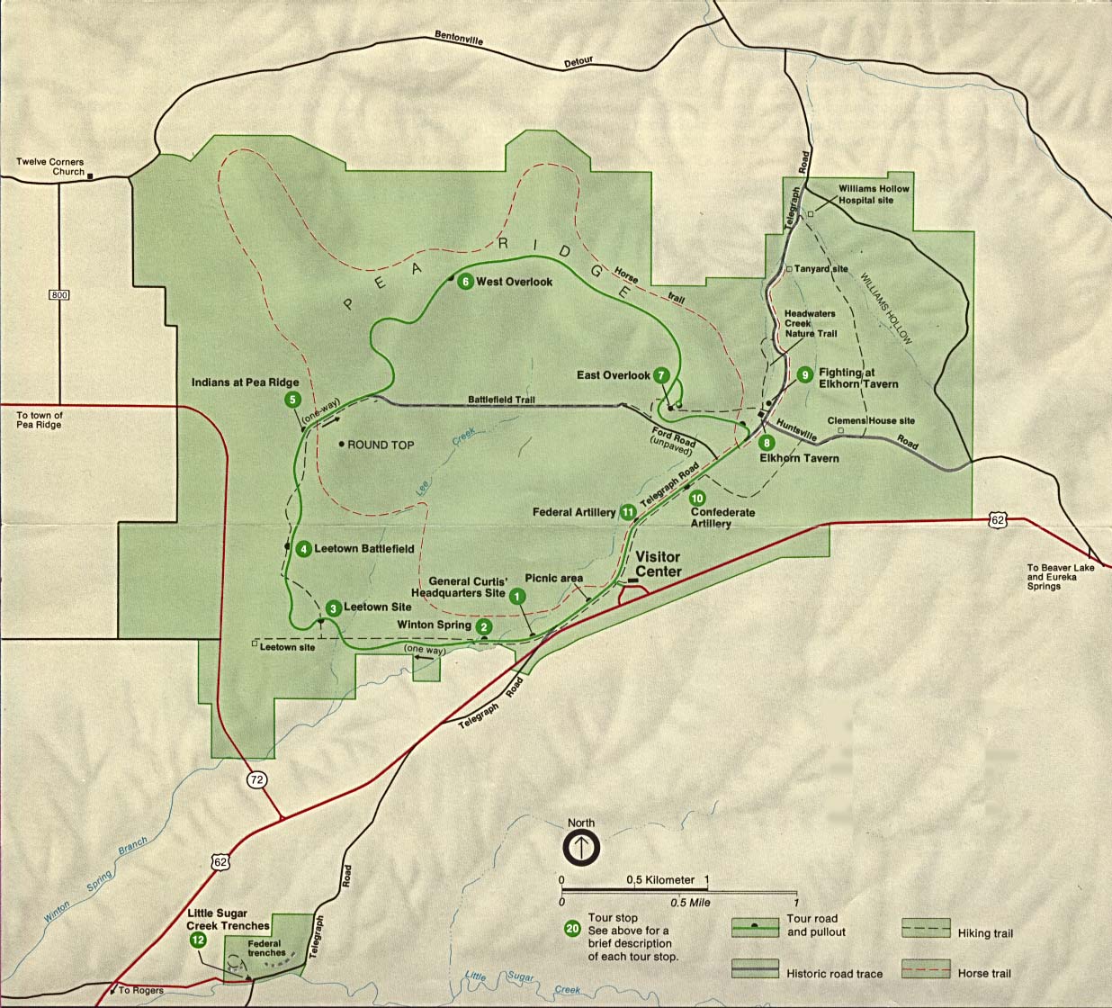
English: Pea Ridge National Military Park park map, originally listed and attributed to the US National Park Service at http://www.lib.utexas.edu/maps/arkansas.html |
|||
| 來源 | http://www.lib.utexas.edu/maps/national_parks/pea_ridge_map.jpg | |||
| 作者 | US National Park Service | |||
| 授權許可 (重用此檔案) |
|
檔案歷史
點選日期/時間以檢視該時間的檔案版本。
| 日期/時間 | 縮圖 | 尺寸 | 使用者 | 備註 | |
|---|---|---|---|---|---|
| 目前 | 2017年12月9日 (六) 15:37 | | 1,236 × 1,120(223 KB) | MarginalCost | {{Information |Description ={{en|1=Pea Ridge National Military Park park map, originally listed and attributed to the US National Park Service at http://www.lib.utexas.edu/maps/arkansas.html}} |Source =http://www.lib.utexas.edu/maps/national... |
檔案用途
下列頁面有用到此檔案:
全域檔案使用狀況
以下其他 wiki 使用了這個檔案:
- en.wikipedia.org 的使用狀況