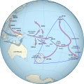
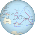
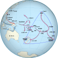
File:Polynesian Migration.svg

此 SVG 檔案的 PNG 預覽的大小:553 × 553 像素。 其他解析度:240 × 240 像素 | 480 × 480 像素 | 768 × 768 像素 | 1,024 × 1,024 像素 | 2,048 × 2,048 像素。
原始檔案 (SVG 檔案,表面大小:553 × 553 像素,檔案大小:664 KB)
檔案歷史
點選日期/時間以檢視該時間的檔案版本。
| 日期/時間 | 縮圖 | 尺寸 | 使用者 | 備註 | |
|---|---|---|---|---|---|
| 目前 | 2024年2月8日 (四) 18:18 |  | 553 × 553(664 KB) | Manlleus | added catalan language |
| 2024年2月8日 (四) 18:08 |  | 553 × 553(716 KB) | Manlleus | fixed text labels for translation | |
| 2024年2月8日 (四) 17:19 |  | 553 × 553(717 KB) | Manlleus | fixed text labels for translation | |
| 2024年2月8日 (四) 17:05 |  | 553 × 553(717 KB) | Manlleus | fixed text labels for translation | |
| 2018年3月3日 (六) 05:08 |  | 553 × 553(445 KB) | Gringer | Removed "d=" from SVG circle objects to improve validation | |
| 2013年7月2日 (二) 03:20 |  | 553 × 553(510 KB) | Gringer | Changed font from Sans/FreeSans to Arial | |
| 2013年7月2日 (二) 03:00 |  | 553 × 553(510 KB) | Gringer | Regenerated background image using updated perlshaper script, converted path-like text to proper text, removed "border as another path" oddness that resulted from previous import from my thesis EPS file. | |
| 2012年3月6日 (二) 17:03 |  | 542 × 542(439 KB) | Gringer | Updated figure from my thesis | |
| 2011年10月19日 (三) 11:52 |  | 750 × 547(176 KB) | AnonMoos | adjust margins, increase default display size | |
| 2008年8月5日 (二) 08:34 |  | 270 × 210(177 KB) | Gringer | {{Information |Description=An equirectangular projection of the world, created from the same data as Image:Worldmap_wdb_combined.svg. Inkscape was used to add colour , clip the land, and add in migration arrows. |Source=self-made |Date=2008-08-05 |Aut |
檔案用途
沒有使用此檔案的頁面。
全域檔案使用狀況
以下其他 wiki 使用了這個檔案:
- af.wikipedia.org 的使用狀況
- ami.wikipedia.org 的使用狀況
- an.wikipedia.org 的使用狀況
- ar.wikipedia.org 的使用狀況
- ban.wikipedia.org 的使用狀況
- ba.wikipedia.org 的使用狀況
- bg.wikipedia.org 的使用狀況
- bjn.wikipedia.org 的使用狀況
- bn.wikipedia.org 的使用狀況
- ca.wikipedia.org 的使用狀況
- cbk-zam.wikipedia.org 的使用狀況
- ckb.wikipedia.org 的使用狀況
- cs.wikipedia.org 的使用狀況
- de.wikipedia.org 的使用狀況
- en.wikipedia.org 的使用狀況
- History of New Zealand
- Hawaiki
- Polynesians
- Polynesian culture
- Portal:New Zealand
- User:Gringer
- Portal:Oceania
- Māori migration canoes
- New Zealand
- History of the Otago Region
- Polynesia
- User:OldManRivers/Maori
- Wikipedia:Reference desk/Archives/Humanities/2011 January 30
- Exploration of the Pacific
- Wikipedia:Reference desk/Archives/Humanities/2011 October 17
- User:Liveste/Māori history
- User:Cruickshanks/sandbox5
檢視此檔案的更多全域使用狀況。


