File:Uvs Nuur drainage basin.jpg

預覽大小:800 × 296 像素。 其他解析度:320 × 118 像素 | 640 × 237 像素 | 1,024 × 379 像素 | 1,280 × 473 像素 | 2,794 × 1,033 像素。
原始檔案 (2,794 × 1,033 像素,檔案大小:1.65 MB,MIME 類型:image/jpeg)
摘要
| 描述 |
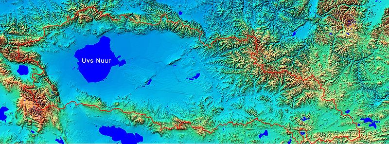
English: Uvs Nuur drainage basin map |
| 日期 |
2008年2月21日 (原始上傳日期) |
| 來源 | SRTM 90 meters elevation model grid, water bodies from NASA; shaded relief picture and basin area line is my own work |
| 作者 | NASA |
| 授權許可 (重用此檔案) |
non commercial use |
授權條款
| 本作品由NASA創作,屬於公有領域。根據NASA的版權政策:“NASA的創作除非另有聲明否則不受版權保護。”(參見:Template:PD-USGov/zh,NASA版權政策或JPL圖像使用政策) | ||
 |
警告:
|
原始上傳日誌
Transferred from en.wikipedia to Commons by Frokor using CommonsHelper.
The original description page was here. All following user names refer to en.wikipedia.
- 2008-02-21 19:08 Bogomolov.PL 2794×1033×8 (1726167 bytes) better image
- 2008-02-21 19:02 Bogomolov.PL 2794×1033×8 (1067330 bytes) {{Information |Description=Uvs Nuur drainage basin map |Source=SRTM 90 meters elevation model grid, water bodies from NASA; shaded relief picture and basin area line is my own work |Date=21.02.2008 |Location=ftp://e0srp01u.ecs.nasa.gov/srtm/version2/SRTM3
檔案歷史
點選日期/時間以檢視該時間的檔案版本。
| 日期/時間 | 縮圖 | 尺寸 | 使用者 | 備註 | |
|---|---|---|---|---|---|
| 目前 | 2008年7月14日 (一) 12:03 | 2,794 × 1,033(1.65 MB) | File Upload Bot (Magnus Manske) | {{BotMoveToCommons|en.wikipedia}} {{Information |Description={{en|Uvs Nuur drainage basin map}} |Source=Transferred from [http://en.wikipedia.org en.wikipedia]; transferred to Commons by User:Frokor using [http://tools.wikimedia.de/~magnus/commonshel |
檔案用途
下列頁面有用到此檔案:
全域檔案使用狀況
以下其他 wiki 使用了這個檔案:
- ar.wikipedia.org 的使用狀況
- bg.wikipedia.org 的使用狀況
- bn.wikipedia.org 的使用狀況
- ca.wikipedia.org 的使用狀況
- cs.wikipedia.org 的使用狀況
- de.wikipedia.org 的使用狀況
- en.wikipedia.org 的使用狀況
- es.wikipedia.org 的使用狀況
- fi.wikipedia.org 的使用狀況
- fr.wikipedia.org 的使用狀況
- hr.wikipedia.org 的使用狀況
- hu.wikipedia.org 的使用狀況
- ja.wikipedia.org 的使用狀況
- ka.wikipedia.org 的使用狀況
- mk.wikipedia.org 的使用狀況
- ml.wikipedia.org 的使用狀況
- mn.wikipedia.org 的使用狀況
- mt.wikipedia.org 的使用狀況
- nl.wikipedia.org 的使用狀況
- nn.wikipedia.org 的使用狀況
- pt.wikipedia.org 的使用狀況
- ru.wikipedia.org 的使用狀況
- sh.wikipedia.org 的使用狀況
- simple.wikipedia.org 的使用狀況
- sr.wikipedia.org 的使用狀況
- tr.wikipedia.org 的使用狀況
- tyv.wikipedia.org 的使用狀況
- uk.wikipedia.org 的使用狀況
- vi.wikipedia.org 的使用狀況
- www.wikidata.org 的使用狀況