File:WW2-Holocaust-Europe-2007Borders DE.png

原始檔案 (1,310 × 1,090 像素,檔案大小:572 KB,MIME 類型:image/png


描述
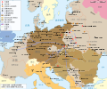
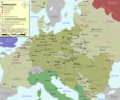
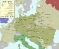
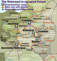
English: Map (with German legend) of the Holocaust in Europe during World War II, 1939-1945.
This map shows all German Nazi extermination camps (or death camps), most major concentration camps, labor camps, prison camps, ghettos, major deportation routes and major massacre sites. Please note that a version with 1942 borders is available here: Image:WW2-Holocaust-Europe.png.

Notes:
1. Extermination camps were dedicated death camps, but all camps and ghettos took a toll of many, many lives.
2. Concentration camps include labor camps, prison camps & transit camps.
3. Not all camps & ghettos are shown.
4. Borders are present borders (2007).
日期 (UTC)
來源
作者
其他版本

[編輯]

歐洲 1942
歐洲 2007
波蘭
烏克蘭
奧斯蘭總督轄區
Northeast Europe


這是一張修飾過的圖片,即本圖片是用軟體修改過後的版本,修改的方式或內容有:legend and title now german。原版圖片來源:WW2-Holocaust-Europe-2007Borders.png。修改者:Emdee

我,本作品的著作權持有者,決定用以下授權條款發佈本作品:
w:zh:創用CC
姓名標示
此檔案採用創用CC 姓名標示 3.0 未在地化版本授權條款。
您可以自由:
  • 分享 – 複製、發佈和傳播本作品
  • 重新修改 – 創作演繹作品
惟需遵照下列條件:
  • 姓名標示 – 您必須指名出正確的製作者,和提供授權條款的連結,以及表示是否有對內容上做出變更。您可以用任何合理的方式來行動,但不得以任何方式表明授權條款是對您許可或是由您所使用。


本圖片是以PNG、GIF或JPEG格式上傳。然而,其中包含的資料或訊息,應該重新建立成可縮放向量圖形SVG)檔案,以更有效率或更準確的方式儲存。如有可能,請上傳本圖片的SVG格式版本。在上傳之後,請修改維基各姊妹計畫中所有使用舊版圖片的條目(列在圖像連結章節中),替換為新版圖片,並在舊圖片的描述頁中加入{{Vector version available|新圖片名稱.svg}}模板,同時移除本模板。

原始上傳日誌

This image is a derivative work of the following images:

  • File:WW2-Holocaust-Europe-2007Borders.png licensed with Cc-by-3.0
    • 2007-12-17T10:40:36Z Dna-webmaster 1310x1090 (785571 Bytes) == Summary == {{Information |Description=Map of the Holocaust in Europe during World War II, 1939-1945. This map shows all extermination camps (or ''death camps''), most major concentration camps, labor camps, prison camps,

Uploaded with derivativeFX

說明

添加單行說明來描述出檔案所代表的內容

在此檔案描寫的項目

描繪內容

檔案歷史

點選日期/時間以檢視該時間的檔案版本。

日期/時間縮⁠圖尺寸使用者備⁠註
目前2009年11月2日 (一) 19:01於 2009年11月2日 (一) 19:01 版本的縮圖1,310 × 1,090(572 KB)Flying SaucerVaivara correction
2009年7月21日 (二) 20:59於 2009年7月21日 (二) 20:59 版本的縮圖1,310 × 1,090(760 KB)Emdeelegende: Allierte (typo!) -> Alliierten (plural) Große Transportroute -> Wichtige Transportroute
2009年7月21日 (二) 16:07於 2009年7月21日 (二) 16:07 版本的縮圖1,310 × 1,090(760 KB)Emdee{{Information |Description={{en|Map (with german legend) of the Holocaust in Europe during World War II, 1939-1945. <br /> This map shows all extermination camps (or ''death camps''), most major concentration camps, labor camps, prison camps, ghettos, maj

下列頁面有用到此檔案:

全域檔案使用狀況

以下其他 wiki 使用了這個檔案: